|
Home
Catalogue
Information
Copyright
Other Stock Image websites

Latest additions -
Athens, ancient ruins, c1775
Pulo Penang, Malaysia, c1840
The Capitol, Washington, 1840
Middlesex county map, 1786
Philadelphia plan (SDUK), 1844
Lancashire county map, 1807
Ireland map, 1773
Austria-Hungary map, 1887
Notre Dame, Paris, 1840
Essex map, 1809
Eastern USA map, 1852
Calcutta view, 1850
Bohemia map, 1773
Dardanelles view, Turkey, 1828
Baltic Sea Tallis map, 1860
Plan of medieval Paris, 1884
Istanbul view, 1770
|
Download Royalty-free Stock Images of historical antique maps of India, Sri-Lanka and Bangladesh
(See also Asia maps for India)
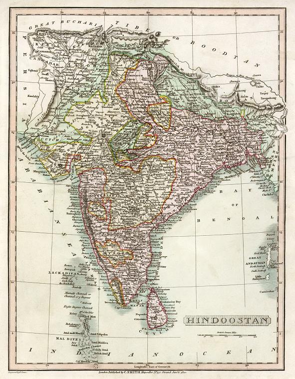
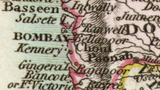
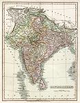 "Hindoostan" engraved by E.Jones, published in Smith's New General Atlas, 1824. The original is a copper engraved map
with original hand colour, pink denoting the British controlled areas. Click
here for detail showing part
of the map (Bombay area) at full resolution (600 dpi). Click the small image
to the left for a larger low resolution version. (Ref sm0043). Digital
image size 40.5 mb at 600 dpi. "Hindoostan" engraved by E.Jones, published in Smith's New General Atlas, 1824. The original is a copper engraved map
with original hand colour, pink denoting the British controlled areas. Click
here for detail showing part
of the map (Bombay area) at full resolution (600 dpi). Click the small image
to the left for a larger low resolution version. (Ref sm0043). Digital
image size 40.5 mb at 600 dpi.
Price 5
USD, Click here to buy
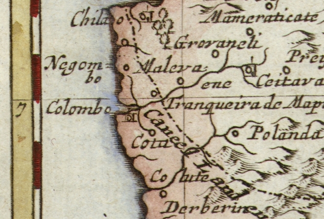
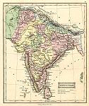 "Hindostan" (India) lithographic map, published by Oliver & Boyd in Ewing's New General Atlas, about 1847. The original hand colour indicates the states in 'British Posession' in red, those 'under British Posession' in yellow and 'Independant States' in green. Click
here for detail showing part
of the map at full resolution (400 dpi). Click the small image
to the left for a larger low resolution version. (Ref sm0211). Digital
image size 12 mb at 400 dpi. "Hindostan" (India) lithographic map, published by Oliver & Boyd in Ewing's New General Atlas, about 1847. The original hand colour indicates the states in 'British Posession' in red, those 'under British Posession' in yellow and 'Independant States' in green. Click
here for detail showing part
of the map at full resolution (400 dpi). Click the small image
to the left for a larger low resolution version. (Ref sm0211). Digital
image size 12 mb at 400 dpi.
Price 5
USD, Click here to buy
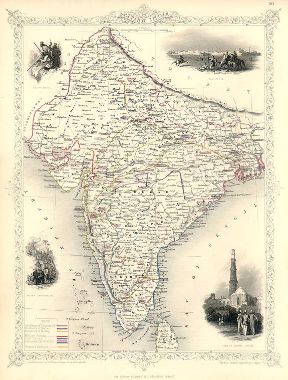
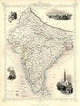 "British India" (Tallis map) drawn and engraved by J.Rapkin, published by The London Printing and Publishing Company, about 1853. The original is a steel engraved map with original
hand colouring, coded to show the various colonial 'posessions' and provinces. Click
here for detail showing part
of the map at full resolution (400 dpi). Click the small image to the left for a larger low resolution version. (Ref sm0156). Digital image
20mb at 400dpi. "British India" (Tallis map) drawn and engraved by J.Rapkin, published by The London Printing and Publishing Company, about 1853. The original is a steel engraved map with original
hand colouring, coded to show the various colonial 'posessions' and provinces. Click
here for detail showing part
of the map at full resolution (400 dpi). Click the small image to the left for a larger low resolution version. (Ref sm0156). Digital image
20mb at 400dpi.
Price 5 USD, Click here to buy
_tn.jpg) "India" (and south east Asia) engraved by G.Sherman after a map by J.Wells, published in McNally's System of Geography, 1860. The original is a lithographic map, with original
hand colouring. Click
here for detail showing part
of the map at full resolution (400 dpi). Click the small image to the left for a larger low resolution version. (Ref sm0223). Digital image
13.9mb at 400dpi. "India" (and south east Asia) engraved by G.Sherman after a map by J.Wells, published in McNally's System of Geography, 1860. The original is a lithographic map, with original
hand colouring. Click
here for detail showing part
of the map at full resolution (400 dpi). Click the small image to the left for a larger low resolution version. (Ref sm0223). Digital image
13.9mb at 400dpi.
Price 5 USD, Click here to buy
_tn.jpg) "A
Map of India on the West Side of the Ganges, Comprehending the Coasts of Malabar,
Cormandel and the Island Ceylon" by Emanuel
Bowen, published about 1744. The original is a copper engraved map
measuring 23 x 32 cms, with later hand colour. Click
here for detail showing part
of the map at full resolution (500 dpi). Click the small image
to the left for a larger low resolution version. (Ref sm0017). Digital
image size 21 mb at 500 dpi. "A
Map of India on the West Side of the Ganges, Comprehending the Coasts of Malabar,
Cormandel and the Island Ceylon" by Emanuel
Bowen, published about 1744. The original is a copper engraved map
measuring 23 x 32 cms, with later hand colour. Click
here for detail showing part
of the map at full resolution (500 dpi). Click the small image
to the left for a larger low resolution version. (Ref sm0017). Digital
image size 21 mb at 500 dpi.
Price 5
USD, Click here to buy
Also available as a photo or giclee print here on MapSeeker
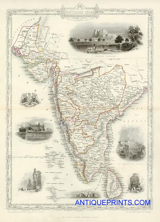
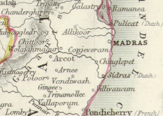
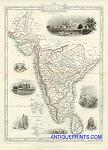 "Southern India" drawn and engraved by J.Rapkin, published in Tallis's illustrated Atlas ..., 1851. The original is a detailed steel engraved map with original hand colouring and a centrefold which is visible on the image. Click
here for detail showing the Madras area at full resolution (400 dpi). Click the small image
to the left for a larger low resolution version. (Ref sm0087). Digital
image size 13.5 mb at 400 dpi. "Southern India" drawn and engraved by J.Rapkin, published in Tallis's illustrated Atlas ..., 1851. The original is a detailed steel engraved map with original hand colouring and a centrefold which is visible on the image. Click
here for detail showing the Madras area at full resolution (400 dpi). Click the small image
to the left for a larger low resolution version. (Ref sm0087). Digital
image size 13.5 mb at 400 dpi.
Price 5
USD, Click here to buy
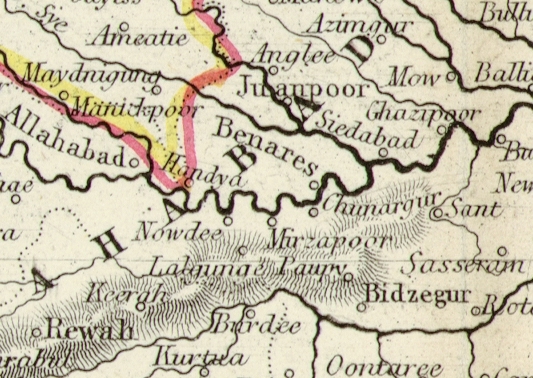
 "Northern India "drawn and engraved by J.Rapkin, published in Tallis's illustrated Atlas ..., 1851. The original is a detailed steel engraved map with original hand colouring (coded to show the various 'posessions') and a centrefold which is visible on the image. Click
here for detail showing the Benares area at full resolution (400 dpi). Click the small image
to the left for a larger low resolution version. (Ref sm0096). Digital
image size 16.5 mb at 400 dpi. "Northern India "drawn and engraved by J.Rapkin, published in Tallis's illustrated Atlas ..., 1851. The original is a detailed steel engraved map with original hand colouring (coded to show the various 'posessions') and a centrefold which is visible on the image. Click
here for detail showing the Benares area at full resolution (400 dpi). Click the small image
to the left for a larger low resolution version. (Ref sm0096). Digital
image size 16.5 mb at 400 dpi.
Price 5
USD, Click here to buy
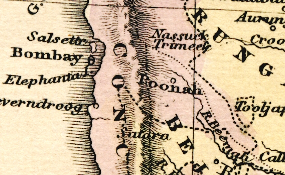
_tn.jpg) Bombay,
India "Plan
de Bombay et de ses Environs Tire de Thornton Hyd. Ang." engraved after Bellin, published about 1751. The original is a copper engraved plan
measuring 26.5 x 19.5 cms, with later hand colour. Click
here for detail showing part
of the map at full resolution (500 dpi). Click the small image
to the left for a larger low resolution version. (Ref sm0016). Digital
image size 13 mb at 500 dpi. Bombay,
India "Plan
de Bombay et de ses Environs Tire de Thornton Hyd. Ang." engraved after Bellin, published about 1751. The original is a copper engraved plan
measuring 26.5 x 19.5 cms, with later hand colour. Click
here for detail showing part
of the map at full resolution (500 dpi). Click the small image
to the left for a larger low resolution version. (Ref sm0016). Digital
image size 13 mb at 500 dpi.
Price 5
USD, Click here to buy
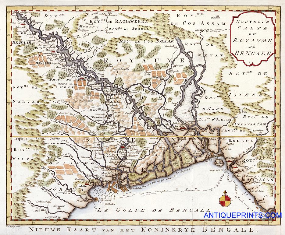
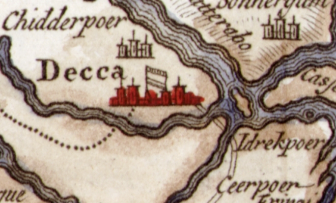
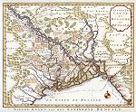 Bengal, India "Nouvelle Carte Du Royaume De Bengale" engraved by by J.V.Schley after a map by Bellin, published about 1773. The original is a nicely detailed copper engraved map, with later hand colour. Click
here for detail showing part
of the map (Decca area) at full resolution (600 dpi). Click the small image
to the left for a larger low resolution version. (Ref sm0064). Digital
image size 33.5 mb at 600 dpi. Bengal, India "Nouvelle Carte Du Royaume De Bengale" engraved by by J.V.Schley after a map by Bellin, published about 1773. The original is a nicely detailed copper engraved map, with later hand colour. Click
here for detail showing part
of the map (Decca area) at full resolution (600 dpi). Click the small image
to the left for a larger low resolution version. (Ref sm0064). Digital
image size 33.5 mb at 600 dpi.
Price 5
USD, Click here to buy
_tn.jpg) Sri
Lanka (Ceylon) "Insula Ceylan Olim Taprobana nunc
incolis Lankawn" by Waesberge, published in Amsterdam
in 1676. The original is a copper engraved map with
old hand colouring. Click
here for detail showing part
of the map at full resolution (600 dpi). Click the small image
to the left for a larger low resolution version. (Ref sm0013). Digital
image size 18 mb at 600 dpi. Sri
Lanka (Ceylon) "Insula Ceylan Olim Taprobana nunc
incolis Lankawn" by Waesberge, published in Amsterdam
in 1676. The original is a copper engraved map with
old hand colouring. Click
here for detail showing part
of the map at full resolution (600 dpi). Click the small image
to the left for a larger low resolution version. (Ref sm0013). Digital
image size 18 mb at 600 dpi.
Price 5
USD, Click here to buy
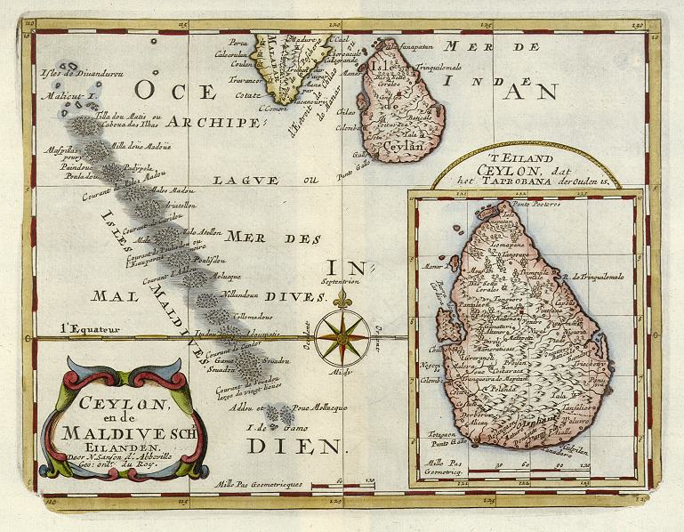
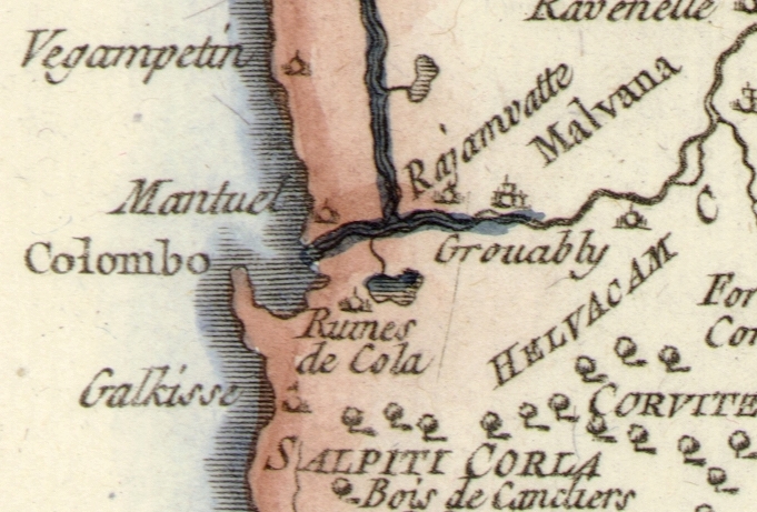
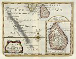 Sri
Lanka & Maldives (Ceylon) "Ceylon en de Maldivische Eilanden" by N.Sanson, published about 1705. The original is a copper engraved map with
later colouring. Click
here for detail showing part
of the map at full resolution (400 dpi). Click the small image
to the left for a larger low resolution version. (Ref sm0180). Digital
image size 10.3 mb at 400 dpi. Sri
Lanka & Maldives (Ceylon) "Ceylon en de Maldivische Eilanden" by N.Sanson, published about 1705. The original is a copper engraved map with
later colouring. Click
here for detail showing part
of the map at full resolution (400 dpi). Click the small image
to the left for a larger low resolution version. (Ref sm0180). Digital
image size 10.3 mb at 400 dpi.
Price 5
USD, Click here to buy
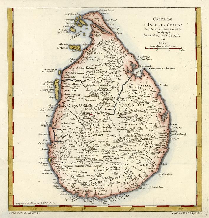
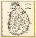 Sri
Lanka (Ceylon) "Carte De L'Isle De Ceylan ..." by Jaques Nicolas Bellin, published about 1760. The original is a copper engraved map with
later hand colouring, measuring about 26 x 27 cms. Click
here for detail showing part
of the map at full resolution (400 dpi). Click the small image
to the left for a larger low resolution version. (Ref sm0123). Digital
image size 13.7 mb at 400 dpi. Sri
Lanka (Ceylon) "Carte De L'Isle De Ceylan ..." by Jaques Nicolas Bellin, published about 1760. The original is a copper engraved map with
later hand colouring, measuring about 26 x 27 cms. Click
here for detail showing part
of the map at full resolution (400 dpi). Click the small image
to the left for a larger low resolution version. (Ref sm0123). Digital
image size 13.7 mb at 400 dpi.
Price 5
USD, Click here to buy
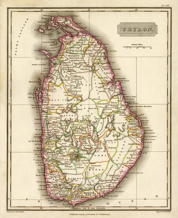
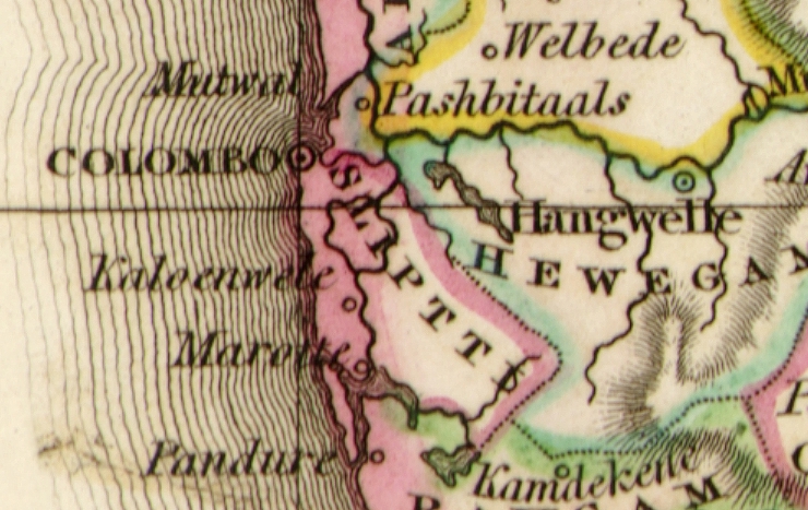
 Sri
Lanka "Ceylon" engraved by Sidney Hall after Aaron Arrowsmith, published by A.Constable, 1823. The original is a copper engraved map with
original colouring. Click
here for detail showing part
of the map at full resolution (600 dpi). Click the small image
to the left for a larger low resolution version. (Ref sm0181). Digital
image size 23 mb at 600 dpi. Sri
Lanka "Ceylon" engraved by Sidney Hall after Aaron Arrowsmith, published by A.Constable, 1823. The original is a copper engraved map with
original colouring. Click
here for detail showing part
of the map at full resolution (600 dpi). Click the small image
to the left for a larger low resolution version. (Ref sm0181). Digital
image size 23 mb at 600 dpi.
Price 5
USD, Click here to buy
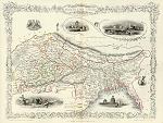
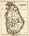
_tn.jpg) "Ceylon" (Sri-Lanka) drawn and engraved by J.Rapkin, published in Tallis's illustrated Atlas ..., 1851. The original is a detailed steel engraved map with original hand colouring and a centrefold which is visible on the image. Click
here for detail showing the Kandy area at full resolution (600 dpi). Click the small image
to the left for a larger low resolution version. (Ref sm0052). Digital
image size 30 mb at 600 dpi. "Ceylon" (Sri-Lanka) drawn and engraved by J.Rapkin, published in Tallis's illustrated Atlas ..., 1851. The original is a detailed steel engraved map with original hand colouring and a centrefold which is visible on the image. Click
here for detail showing the Kandy area at full resolution (600 dpi). Click the small image
to the left for a larger low resolution version. (Ref sm0052). Digital
image size 30 mb at 600 dpi.
Price 5
USD, Click here to buy
|
|


.jpg)
-small.jpg)

-small.jpg)
.jpg)
.jpg)
-d.jpg)
-d.jpg)
-d.jpg)
-d.jpg)
-d.jpg)