|
Home
Catalogue
Information
Copyright
Other Stock Image websites

Latest additions -
Athens, ancient ruins, c1775
Pulo Penang, Malaysia, c1840
The Capitol, Washington, 1840
Middlesex county map, 1786
Philadelphia plan (SDUK), 1844
Lancashire county map, 1807
Ireland map, 1773
Austria-Hungary map, 1887
Notre Dame, Paris, 1840
Essex map, 1809
Eastern USA map, 1852
Calcutta view, 1850
Bohemia map, 1773
Dardanelles view, Turkey, 1828
Baltic Sea Tallis map, 1860
Plan of medieval Paris, 1884
Istanbul view, 1770
|
Download Royalty-free Stock Images of historical antique maps of Europe.
_tn.jpg) "An Accurate Map of Europe, laid down from the Best Authorities" anonymous
engraver. Copper engraved map published about 1760, recent hand colouring. Click
here for detail showing part
of the map at full resolution (500 dpi). Click the small image
to the left for a larger low resolution version. (Ref sm0026). Digital
image size 12 mb at 500 dpi. "An Accurate Map of Europe, laid down from the Best Authorities" anonymous
engraver. Copper engraved map published about 1760, recent hand colouring. Click
here for detail showing part
of the map at full resolution (500 dpi). Click the small image
to the left for a larger low resolution version. (Ref sm0026). Digital
image size 12 mb at 500 dpi.
Price 5
USD, Click here to buy
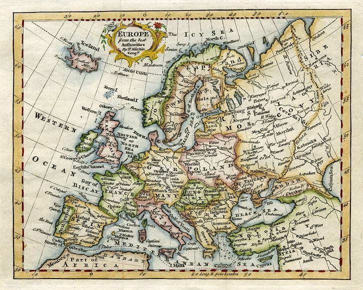
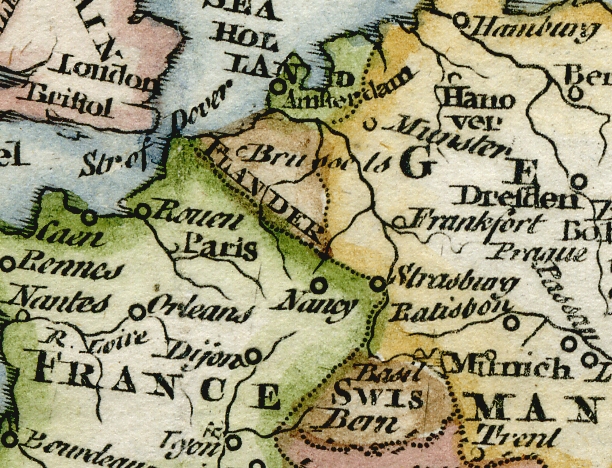
 "Europe from the best Authorities, By Tho.Kitchin Geogr." published in The Modern Gazetteer..., about 1770. The original is a copper engraved map
with recent hand colouring, measuring about 18.5 x 15 cms plus margins. Click
here for detail showing part
of the map at full resolution (400 dpi). Click the small image to the left for a larger low resolution version. (Ref sm0193). Digital image
7.9mb at 400dpi. "Europe from the best Authorities, By Tho.Kitchin Geogr." published in The Modern Gazetteer..., about 1770. The original is a copper engraved map
with recent hand colouring, measuring about 18.5 x 15 cms plus margins. Click
here for detail showing part
of the map at full resolution (400 dpi). Click the small image to the left for a larger low resolution version. (Ref sm0193). Digital image
7.9mb at 400dpi.
Price 5 USD, Click here to buy
_tn.jpg) "Europe" engraved by Thomas Jefferys. Copper engraved map published in A New Geographical and Historical Grammar ..., 1772, with recent hand colouring. The original measures 23 x 18.5 cms plus margins. Click
here for detail showing part
of the map at full resolution (400 dpi). Click the small image
to the left for a larger low resolution version. (Ref sm0102). Digital
image size 9.5 mb at 400 dpi. "Europe" engraved by Thomas Jefferys. Copper engraved map published in A New Geographical and Historical Grammar ..., 1772, with recent hand colouring. The original measures 23 x 18.5 cms plus margins. Click
here for detail showing part
of the map at full resolution (400 dpi). Click the small image
to the left for a larger low resolution version. (Ref sm0102). Digital
image size 9.5 mb at 400 dpi.
Price 5
USD, Click here to buy
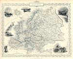 "Europe" drawn and engraved by J.Rapkin, published by The London Printing and Publishing Company, about 1853. The original is a decorative steel engraved map with original
hand colouring. Click
here for detail showing part
of the map at full resolution (400 dpi). Click the small image to the left for a larger low resolution version. (Ref sm0167). Digital image
17.6mb at 400dpi. "Europe" drawn and engraved by J.Rapkin, published by The London Printing and Publishing Company, about 1853. The original is a decorative steel engraved map with original
hand colouring. Click
here for detail showing part
of the map at full resolution (400 dpi). Click the small image to the left for a larger low resolution version. (Ref sm0167). Digital image
17.6mb at 400dpi.
Price 5 USD, Click here to buy
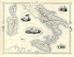
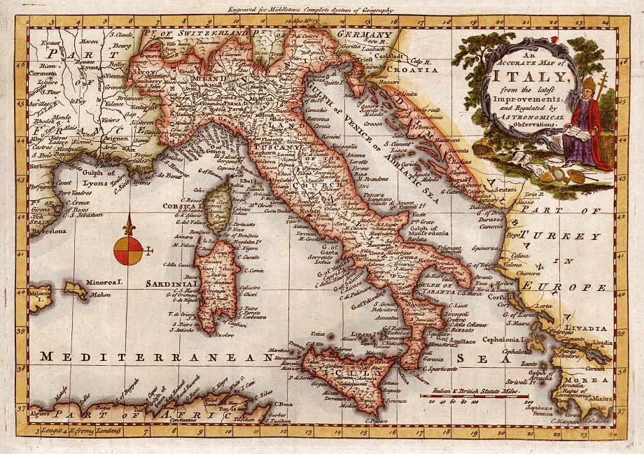
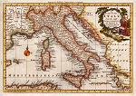 "An Accurate Map of Italy, from the Latest Improvements and Regulated by Astronomical Observation" anonymous
engraver, published in Middleton's Complete System of Geography, about 1777. The original is a copper engraved map with recent hand colouring. Click
here for detail showing part
of the map at full resolution (400 dpi). Click the small image
to the left for a larger low resolution version. (Ref sm0039). Digital
image size 23 mb at 400 dpi. "An Accurate Map of Italy, from the Latest Improvements and Regulated by Astronomical Observation" anonymous
engraver, published in Middleton's Complete System of Geography, about 1777. The original is a copper engraved map with recent hand colouring. Click
here for detail showing part
of the map at full resolution (400 dpi). Click the small image
to the left for a larger low resolution version. (Ref sm0039). Digital
image size 23 mb at 400 dpi.
Price 5
USD, Click here to buy
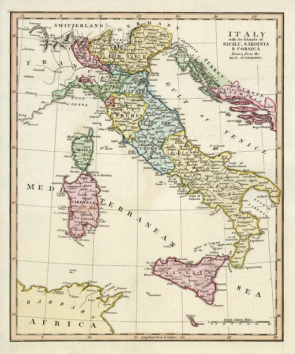
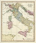 "Italy with the Islands of Sicily, Sardinia & Corsica. Drawn from the Best Authorities" anonymous
engraver, published in Robert Wilkinson's General Atlas ..., about 1800. The original is a copper engraved map with original hand colouring. Click
here for detail showing part
of the map at full resolution (500 dpi). Click the small image
to the left for a larger low resolution version. (Ref sm0171). Digital
image size 17 mb at 500 dpi. "Italy with the Islands of Sicily, Sardinia & Corsica. Drawn from the Best Authorities" anonymous
engraver, published in Robert Wilkinson's General Atlas ..., about 1800. The original is a copper engraved map with original hand colouring. Click
here for detail showing part
of the map at full resolution (500 dpi). Click the small image
to the left for a larger low resolution version. (Ref sm0171). Digital
image size 17 mb at 500 dpi.
Price 5
USD, Click here to buy
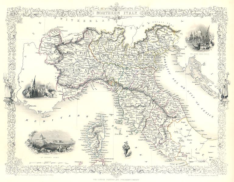
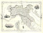 "Northern Italy" drawn and engraved by J.Rapkin, published by The London Printing and Publishing Company, about 1853. The original is a decorative steel engraved map with original
hand colouring. Click
here for detail showing part
of the map at full resolution (400 dpi). Click the small image to the left for a larger low resolution version. (Ref sm0173). Digital image
15.6mb at 400dpi. "Northern Italy" drawn and engraved by J.Rapkin, published by The London Printing and Publishing Company, about 1853. The original is a decorative steel engraved map with original
hand colouring. Click
here for detail showing part
of the map at full resolution (400 dpi). Click the small image to the left for a larger low resolution version. (Ref sm0173). Digital image
15.6mb at 400dpi.
Price 5 USD, Click here to buy
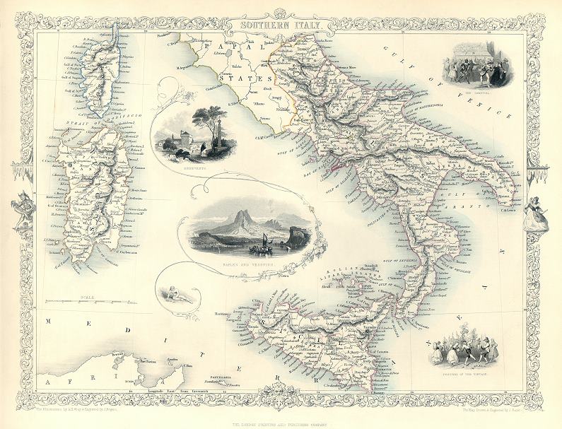
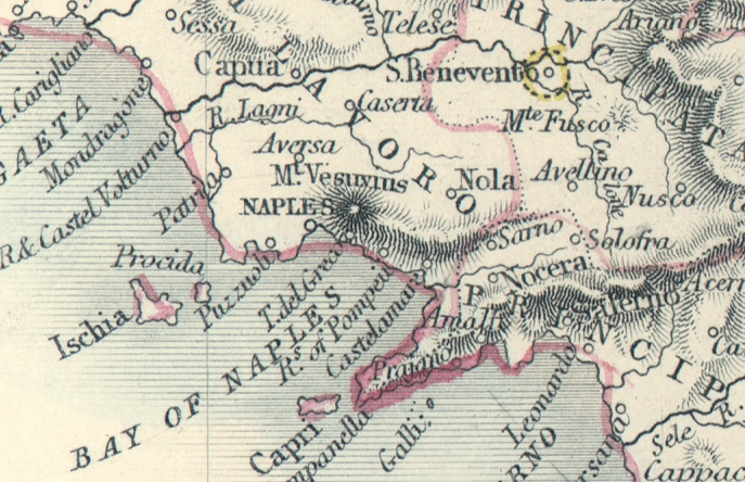
 "Southern Italy" drawn and engraved by J.Rapkin, published by The London Printing and Publishing Company, about 1853. The original is a decorative steel engraved map with original
hand colouring. Click
here for detail showing part
of the map at full resolution (400 dpi). Click the small image to the left for a larger low resolution version. (Ref sm0175). Digital image
17.8mb at 400dpi. "Southern Italy" drawn and engraved by J.Rapkin, published by The London Printing and Publishing Company, about 1853. The original is a decorative steel engraved map with original
hand colouring. Click
here for detail showing part
of the map at full resolution (400 dpi). Click the small image to the left for a larger low resolution version. (Ref sm0175). Digital image
17.8mb at 400dpi.
Price 5 USD, Click here to buy
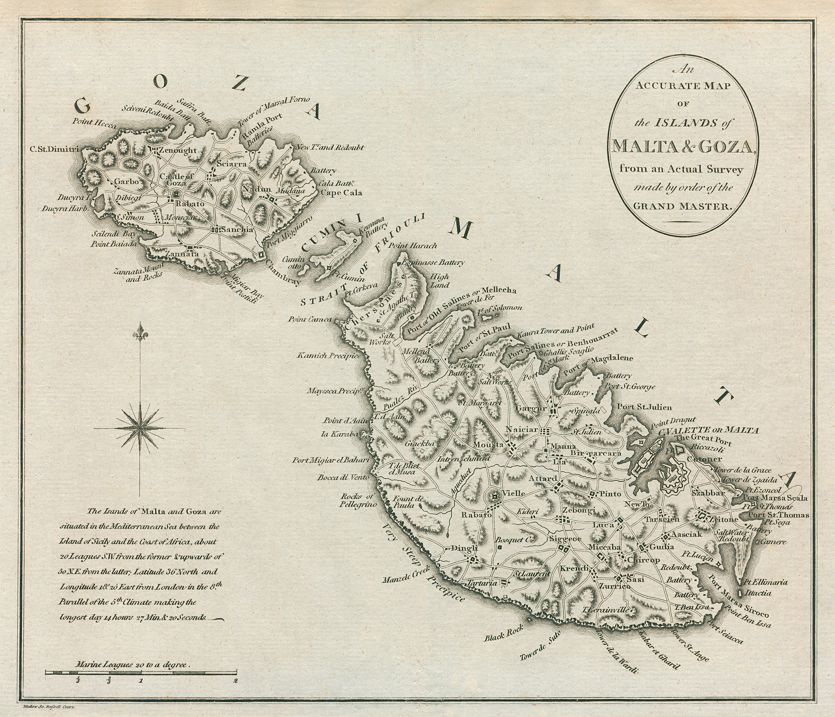
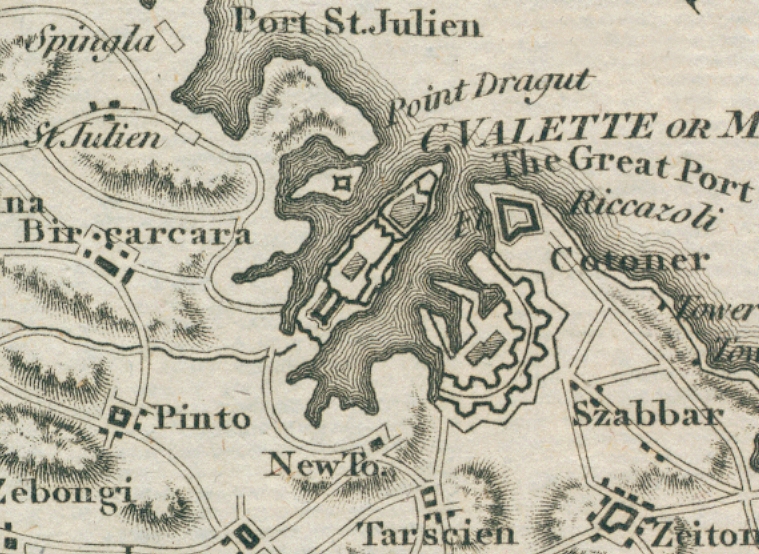
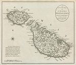 "An Accurate Map of the Islands of Malta & Goza, from a Actual Survey ..." engraved by Mutlow. The original is a detailed copper engraved map published about 1800. Click
here for detail showing part
of the map at full resolution (400 dpi). Click the small image to the left for a larger low resolution version. (Ref sm0256). Digital image
9.7mb at 400dpi. "An Accurate Map of the Islands of Malta & Goza, from a Actual Survey ..." engraved by Mutlow. The original is a detailed copper engraved map published about 1800. Click
here for detail showing part
of the map at full resolution (400 dpi). Click the small image to the left for a larger low resolution version. (Ref sm0256). Digital image
9.7mb at 400dpi.
Price 5 USD, Click here to buy
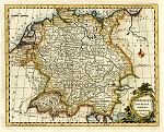
_tn.jpg) "Poland, Lithuania and Prussia " by Thomas Jefferys, published in A New Geographical and Historical Grammar, 1772. The original is a copper engraved map
with recent hand colouring, measuring 21 x 17 cms plus margins. Click
here for detail showing part
of the map at full resolution (500 dpi). Click the small image to the left for a larger low resolution version. (Ref sm0083). Digital image
11.5mb at 500dpi. "Poland, Lithuania and Prussia " by Thomas Jefferys, published in A New Geographical and Historical Grammar, 1772. The original is a copper engraved map
with recent hand colouring, measuring 21 x 17 cms plus margins. Click
here for detail showing part
of the map at full resolution (500 dpi). Click the small image to the left for a larger low resolution version. (Ref sm0083). Digital image
11.5mb at 500dpi.
Price 5 USD, Click here to buy
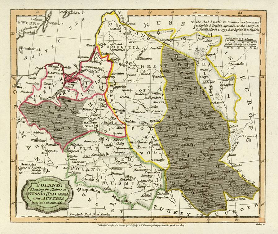
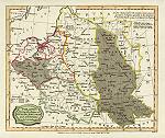 "Poland, Shewing the claims of Russia, Prussia and Austria ..." engraved by Barlow, published in the Rev. E. Blomfield's Geography, 1807. The original is a copper engraved map with
original hand colouring. Click
here for detail showing part
of the map at full resolution (400 dpi). Click the small image
to the left for a larger low resolution version. (Ref sm0008). Digital
image size 8.5 mb at 400 dpi. "Poland, Shewing the claims of Russia, Prussia and Austria ..." engraved by Barlow, published in the Rev. E. Blomfield's Geography, 1807. The original is a copper engraved map with
original hand colouring. Click
here for detail showing part
of the map at full resolution (400 dpi). Click the small image
to the left for a larger low resolution version. (Ref sm0008). Digital
image size 8.5 mb at 400 dpi.
Price 5
USD, Click here to buy
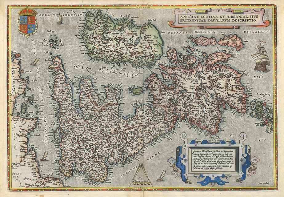
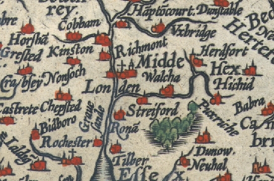
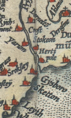
 "Angliae, Scotiae, et Hiberniae, sive Britannicae Insularum Descriptio." (map of the British Isles) by A. Ortelius, published about 1584 or later. The original is a copper engraved map with
old hand colouring. Click
here for detail showing part
of the map (London area) at full resolution (400 dpi). Click the small image
to the left for a larger low resolution version. NOTE - the original has some damage to the lower part of the centrefold and slight dampstaining to the upper portion. Also, my image is made of two joined scans, the join is down the centrefold but does just show - see this detail. (Ref sm0065). Digital
image size 29 mb at 400 dpi. "Angliae, Scotiae, et Hiberniae, sive Britannicae Insularum Descriptio." (map of the British Isles) by A. Ortelius, published about 1584 or later. The original is a copper engraved map with
old hand colouring. Click
here for detail showing part
of the map (London area) at full resolution (400 dpi). Click the small image
to the left for a larger low resolution version. NOTE - the original has some damage to the lower part of the centrefold and slight dampstaining to the upper portion. Also, my image is made of two joined scans, the join is down the centrefold but does just show - see this detail. (Ref sm0065). Digital
image size 29 mb at 400 dpi.
Price 5
USD, Click here to buy
_tn.jpg) "Carte des Isles Britaniques ... " (Map of the British Isles) engraved by Borde, published in Histoire Universelle, about 1760. The original is a copper engraved map with
recent hand colouring. Click
here for detail showing part
of the map at full resolution (500 dpi). Click the small image
to the left for a larger low resolution version. (Ref sm0050). Digital
image size 20 mb at 500 dpi. "Carte des Isles Britaniques ... " (Map of the British Isles) engraved by Borde, published in Histoire Universelle, about 1760. The original is a copper engraved map with
recent hand colouring. Click
here for detail showing part
of the map at full resolution (500 dpi). Click the small image
to the left for a larger low resolution version. (Ref sm0050). Digital
image size 20 mb at 500 dpi.
Price 5
USD, Click here to buy
_tn.jpg) "Saxon England according to the Saxon Chronicle" engraved by A.Bell, published in History
of Great Britain, about 1790. The original is a copper engraved map with
recent hand colouring, measuring 22.5 x 34 cms. Click
here for detail showing part
of the map at full resolution (500 dpi). Click the small image
to the left for a larger low resolution version. (Ref sm0024). Digital
image size 20 mb at 500 dpi. "Saxon England according to the Saxon Chronicle" engraved by A.Bell, published in History
of Great Britain, about 1790. The original is a copper engraved map with
recent hand colouring, measuring 22.5 x 34 cms. Click
here for detail showing part
of the map at full resolution (500 dpi). Click the small image
to the left for a larger low resolution version. (Ref sm0024). Digital
image size 20 mb at 500 dpi.
Price 5
USD, Click here to buy
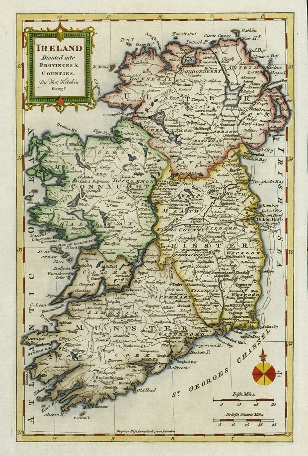
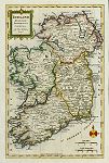 "Ireland,
Divided into Provinces & Counties, by Thos. Kitchin, Geogr."
copper engraved antique map by G.Rollos, published in Fenning's A New
System of Geography ..., 1773. The original is a copper engraved map
with recent hand colouring, measuring 18.5 x 29 cms plus margins.
Click
here for detail showing part
of the map at full resolution (400 dpi). Click the small image to the left for a larger low resolution version. (Ref sm0276). Digital image
15mb at 400dpi. "Ireland,
Divided into Provinces & Counties, by Thos. Kitchin, Geogr."
copper engraved antique map by G.Rollos, published in Fenning's A New
System of Geography ..., 1773. The original is a copper engraved map
with recent hand colouring, measuring 18.5 x 29 cms plus margins.
Click
here for detail showing part
of the map at full resolution (400 dpi). Click the small image to the left for a larger low resolution version. (Ref sm0276). Digital image
15mb at 400dpi.
Price 5 USD, Click here to buy
_tn.jpg) "Ireland" by Thomas Jefferys, published in A New Geographical and Historical Grammar, 1772. The original is a copper engraved map
with recent hand colouring, measuring 19 x 18 cms plus margins. Click
here for detail showing part
of the map at full resolution (500 dpi). Click the small image to the left for a larger low resolution version. (Ref sm0084). Digital image
11mb at 500dpi. "Ireland" by Thomas Jefferys, published in A New Geographical and Historical Grammar, 1772. The original is a copper engraved map
with recent hand colouring, measuring 19 x 18 cms plus margins. Click
here for detail showing part
of the map at full resolution (500 dpi). Click the small image to the left for a larger low resolution version. (Ref sm0084). Digital image
11mb at 500dpi.
Price 5 USD, Click here to buy
_tn.jpg) "A New and Correct Map of Ireland, from the Latest Surveys of that Kingdom " anonymous engraver, published in History of England from the very earliest period ... , about 1790. The original is a copper engraved map with
recent hand colouring. Click
here for detail showing part
of the map at full resolution (400 dpi). Click the small image
to the left for a larger low resolution version. (Ref sm0026). Digital
image size 14 mb at 400 dpi. "A New and Correct Map of Ireland, from the Latest Surveys of that Kingdom " anonymous engraver, published in History of England from the very earliest period ... , about 1790. The original is a copper engraved map with
recent hand colouring. Click
here for detail showing part
of the map at full resolution (400 dpi). Click the small image
to the left for a larger low resolution version. (Ref sm0026). Digital
image size 14 mb at 400 dpi.
Price 5
USD, Click here to buy
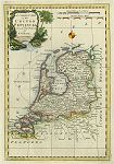
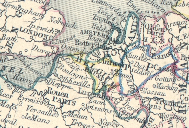
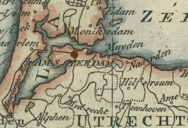
_tn.jpg) "A New Map of the United Netherlands ... " by Thomas Kitchin, published in Busching's A New System of Geography, 1762. The original is a very decorative copper engraved map with
recent hand colouring. Click
here for detail showing part
of the map (Amsterdam area) at full resolution (500 dpi). Click the small image
to the left for a larger low resolution version. (Ref sm0060). Digital
image size 16 mb at 500 dpi. "A New Map of the United Netherlands ... " by Thomas Kitchin, published in Busching's A New System of Geography, 1762. The original is a very decorative copper engraved map with
recent hand colouring. Click
here for detail showing part
of the map (Amsterdam area) at full resolution (500 dpi). Click the small image
to the left for a larger low resolution version. (Ref sm0060). Digital
image size 16 mb at 500 dpi.
Price 5
USD, Click here to buy
 "A Correct Map of the United Provinces from the Best Authorities, by J.Gibson" published in Fenning's A New System of Geography, 1773. The original is a decorative copper engraved map with
recent hand colouring, measuring 18 x 27 cms, plus margins. Click
here for detail showing part
of the map at full resolution (400 dpi). Click the small image
to the left for a larger low resolution version. (Ref sm0234). Digital
image size 12.6 mb at 400 dpi. "A Correct Map of the United Provinces from the Best Authorities, by J.Gibson" published in Fenning's A New System of Geography, 1773. The original is a decorative copper engraved map with
recent hand colouring, measuring 18 x 27 cms, plus margins. Click
here for detail showing part
of the map at full resolution (400 dpi). Click the small image
to the left for a larger low resolution version. (Ref sm0234). Digital
image size 12.6 mb at 400 dpi.
Price 5
USD, Click here to buy
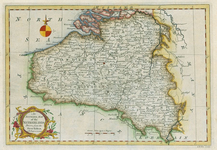
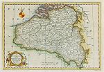 "An Accurate Map of the Netherlands, Drawn from the Sieur Robert, with Improvements" by G.Rollos, published in Fenning's A New System of Geography, 1773. The original is a decorative copper engraved map with
recent hand colouring, measuring 29 x 20 cms, plus margins. Click
here for detail showing part
of the map at full resolution (400 dpi). Click the small image
to the left for a larger low resolution version. (Ref sm0246). Digital
image size 14.3 mb at 400 dpi. "An Accurate Map of the Netherlands, Drawn from the Sieur Robert, with Improvements" by G.Rollos, published in Fenning's A New System of Geography, 1773. The original is a decorative copper engraved map with
recent hand colouring, measuring 29 x 20 cms, plus margins. Click
here for detail showing part
of the map at full resolution (400 dpi). Click the small image
to the left for a larger low resolution version. (Ref sm0246). Digital
image size 14.3 mb at 400 dpi.
Price 5
USD, Click here to buy
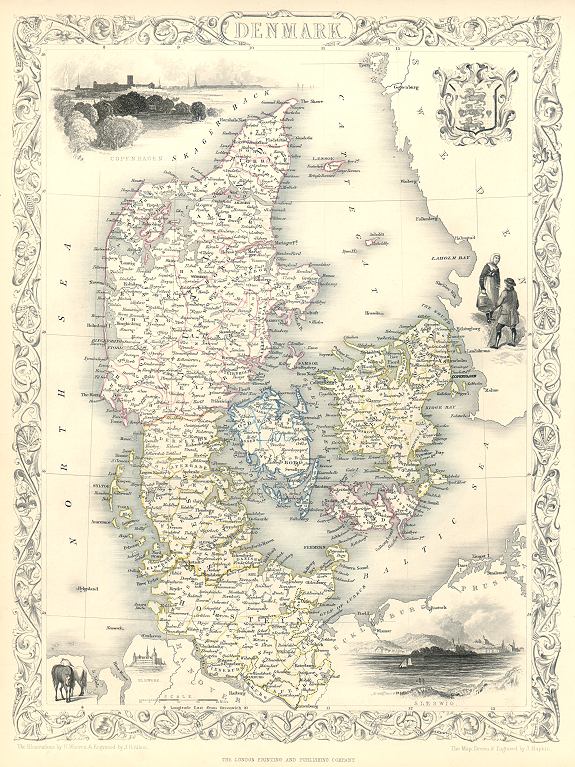
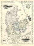 "Denmark" drawn and engraved by J.Rapkin, published by The London Printing and Publishing Company, about 1853. The original is a decorative steel engraved map with original
hand colouring. Click
here for detail showing part
of the map at full resolution (400 dpi). Click the small image to the left for a larger low resolution version. (Ref sm0195). Digital image
17mb at 400dpi. "Denmark" drawn and engraved by J.Rapkin, published by The London Printing and Publishing Company, about 1853. The original is a decorative steel engraved map with original
hand colouring. Click
here for detail showing part
of the map at full resolution (400 dpi). Click the small image to the left for a larger low resolution version. (Ref sm0195). Digital image
17mb at 400dpi.
Price 5 USD, Click here to buy
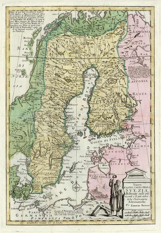
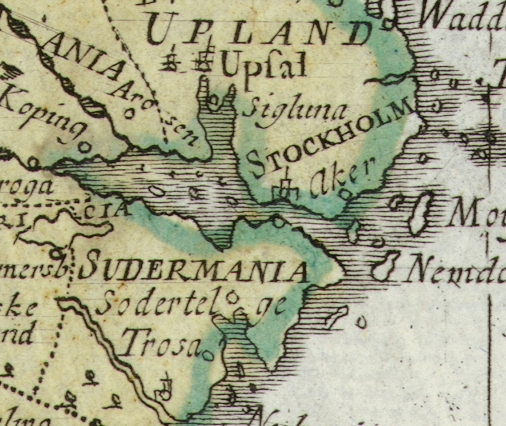
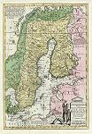 "Nuova Esatta Carta della Svezia, ... Da Emman Bowen" (Sweden) drawn and engraved by Emanuel Bowen, published about 1750. The original is a copper engraved map with original
hand colouring. Click
here for detail showing part
of the map at full resolution (400 dpi). Click the small image to the left for a larger low resolution version. (Ref sm0229). Digital image
15.6mb at 400dpi. "Nuova Esatta Carta della Svezia, ... Da Emman Bowen" (Sweden) drawn and engraved by Emanuel Bowen, published about 1750. The original is a copper engraved map with original
hand colouring. Click
here for detail showing part
of the map at full resolution (400 dpi). Click the small image to the left for a larger low resolution version. (Ref sm0229). Digital image
15.6mb at 400dpi.
Price 5 USD, Click here to buy
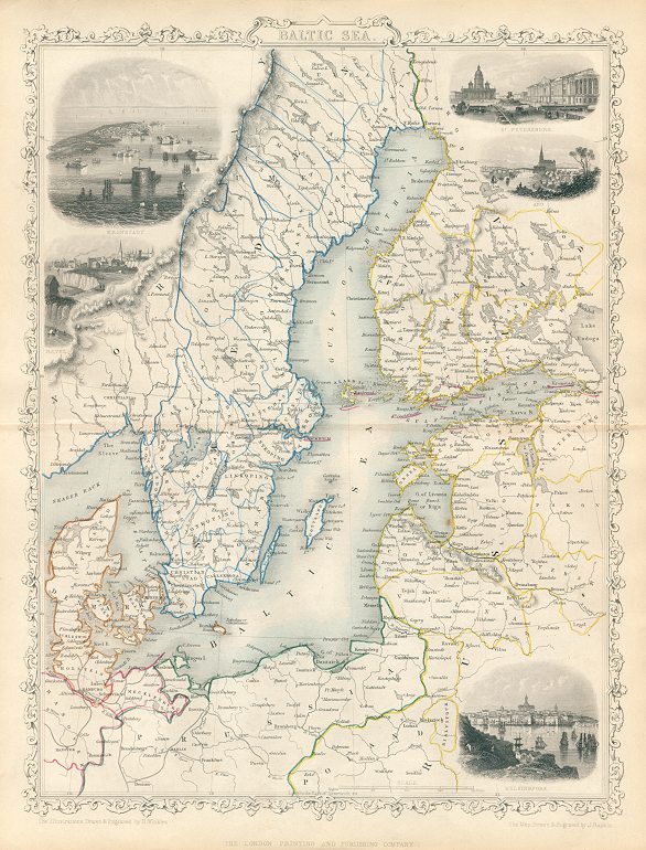
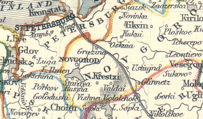
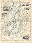 "Baltic Sea" drawn and engraved by J.Rapkin, published by The London Printing and Publishing Company, about 1860. The original is a decorative steel engraved map with original
hand colouring and centrefold as published, measuring 25 x 33 cms. The vignettes show Kronstadt, Revel, St.Petersburg, Abo and Helsingfors. Click
here for detail showing part
of the map at full resolution (400 dpi). Click the small image to the left for a larger low resolution version. (Ref sm0271). Digital image
18.5mb at 400dpi. "Baltic Sea" drawn and engraved by J.Rapkin, published by The London Printing and Publishing Company, about 1860. The original is a decorative steel engraved map with original
hand colouring and centrefold as published, measuring 25 x 33 cms. The vignettes show Kronstadt, Revel, St.Petersburg, Abo and Helsingfors. Click
here for detail showing part
of the map at full resolution (400 dpi). Click the small image to the left for a larger low resolution version. (Ref sm0271). Digital image
18.5mb at 400dpi.
Price 5 USD, Click here to buy
_tn.jpg) "Spain and Portugal" with a chart of the
Lisbon area. Published in The Gentleman's Magazine, 1756. The original is a copper engraved map with
recent hand colouring, measuring 18.5 x 23 cms. Click
here for detail showing part
of the map at full resolution (500 dpi). Click the small image
to the left for a larger low resolution version. (Ref sm0028). Digital
image size 13 mb at 500 dpi. "Spain and Portugal" with a chart of the
Lisbon area. Published in The Gentleman's Magazine, 1756. The original is a copper engraved map with
recent hand colouring, measuring 18.5 x 23 cms. Click
here for detail showing part
of the map at full resolution (500 dpi). Click the small image
to the left for a larger low resolution version. (Ref sm0028). Digital
image size 13 mb at 500 dpi.
Price 5
USD, Click here to buy
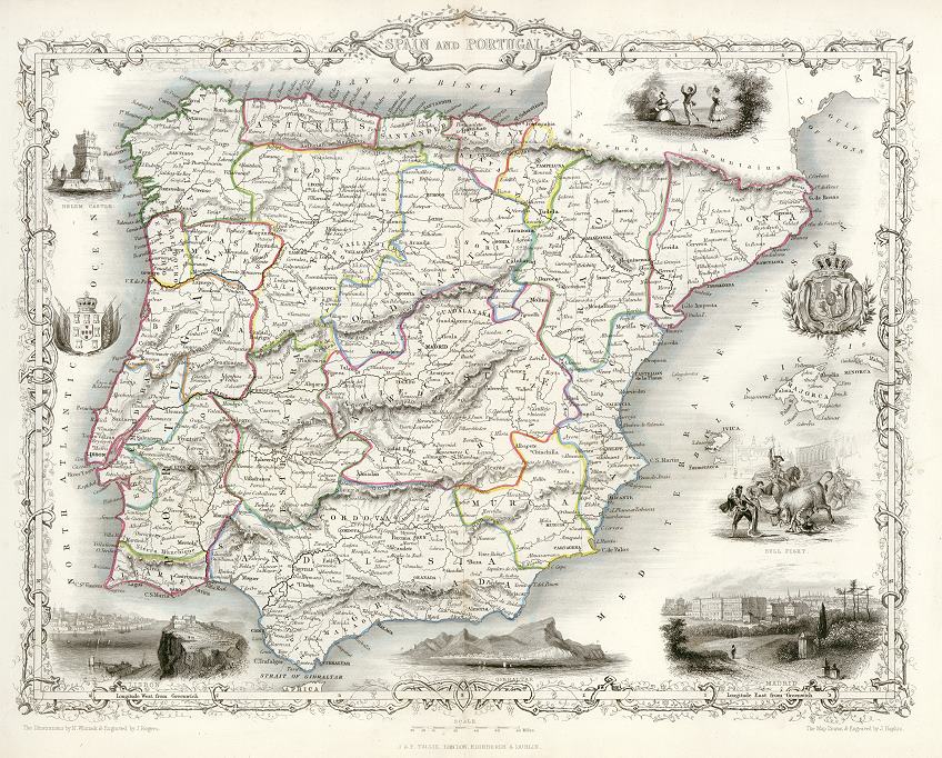
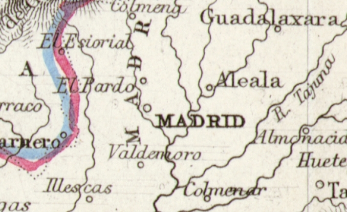
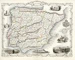 "Spain and Portugal" drawn and engraved by J.Rapkin, published in Tallis's illustrated Atlas ..., 1851. The original is a detailed steel engraved map with original hand colouring and a centrefold which is visible on the image. Click
here for detail showing the Madrid area at full resolution (600 dpi). Click the small image
to the left for a larger low resolution version. (Ref sm0126). Digital
image size 35 mb at 600 dpi. "Spain and Portugal" drawn and engraved by J.Rapkin, published in Tallis's illustrated Atlas ..., 1851. The original is a detailed steel engraved map with original hand colouring and a centrefold which is visible on the image. Click
here for detail showing the Madrid area at full resolution (600 dpi). Click the small image
to the left for a larger low resolution version. (Ref sm0126). Digital
image size 35 mb at 600 dpi.
Price 5
USD, Click here to buy
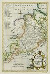
_tn.jpg) "Moscovia, or Russia, Divided into it's General Parts &c." by Herman Moll, published in his Compleat Geographer, 1723. The original is a copper engraved map with
recent hand colouring. Click
here for detail showing part
of the map at full resolution (600 dpi). Click the small image
to the left for a larger low resolution version. (Ref sm0035). Digital
image size 14.5 mb at 600 dpi. "Moscovia, or Russia, Divided into it's General Parts &c." by Herman Moll, published in his Compleat Geographer, 1723. The original is a copper engraved map with
recent hand colouring. Click
here for detail showing part
of the map at full resolution (600 dpi). Click the small image
to the left for a larger low resolution version. (Ref sm0035). Digital
image size 14.5 mb at 600 dpi.
Price 5
USD, Click here to buy
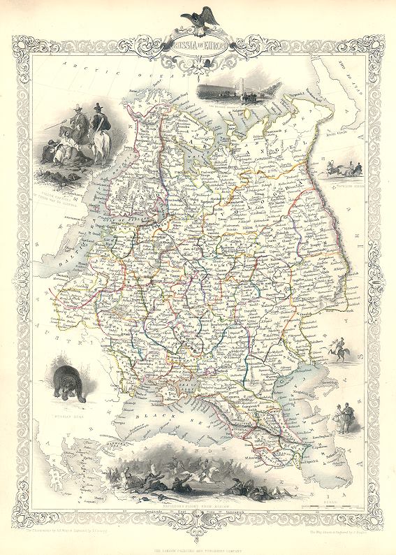
 "Russia in Europe" drawn and engraved by J.Rapkin, published by The London Printing and Publishing Company, about 1853. The original is a decorative steel engraved map with original
hand colouring. Click
here for detail showing part
of the map at full resolution (400 dpi). Click the small image to the left for a larger low resolution version. (Ref sm0203). Digital image
20.7mb at 400dpi. "Russia in Europe" drawn and engraved by J.Rapkin, published by The London Printing and Publishing Company, about 1853. The original is a decorative steel engraved map with original
hand colouring. Click
here for detail showing part
of the map at full resolution (400 dpi). Click the small image to the left for a larger low resolution version. (Ref sm0203). Digital image
20.7mb at 400dpi.
Price 5 USD, Click here to buy
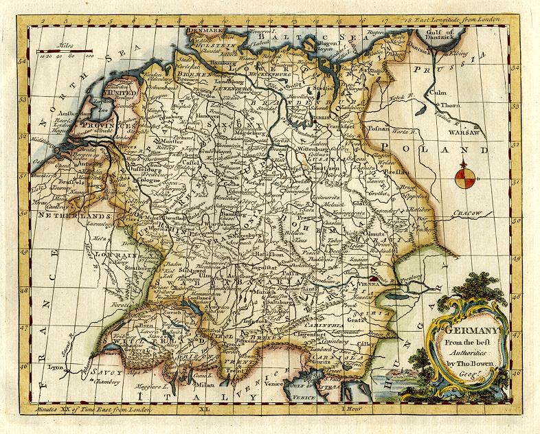
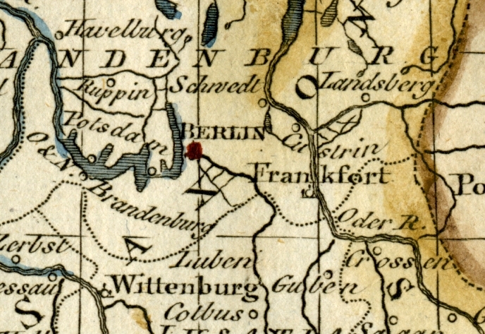
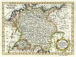 "An Accurate Map of Germany. Drawn from the best Authorities By T.Kitchin Geogr." drawn and etched by Thomas Kitchin, published in The Modern Gazetteer ..., about 1770. The original is a copper engraved map with
recent hand colouring, measuring 20 x 14.5 cms. Click
here for detail showing part
of the map at full resolution (400 dpi). Click the small image
to the left for a larger low resolution version. (Ref sm0216). Digital
image size 10 mb at 500 dpi. "An Accurate Map of Germany. Drawn from the best Authorities By T.Kitchin Geogr." drawn and etched by Thomas Kitchin, published in The Modern Gazetteer ..., about 1770. The original is a copper engraved map with
recent hand colouring, measuring 20 x 14.5 cms. Click
here for detail showing part
of the map at full resolution (400 dpi). Click the small image
to the left for a larger low resolution version. (Ref sm0216). Digital
image size 10 mb at 500 dpi.
Price 5
USD, Click here to buy
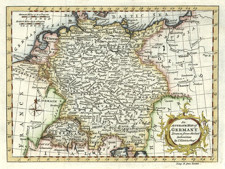
 "Germany from the Best Authorities, by Tho. Bowen, geogr" by Thomas Bowen, published about, 1780. The original is a copper engraved map with
recent hand colouring, measuring 23 x 18 cms. Click
here for detail showing part
of the map at full resolution (400 dpi). Click the small image
to the left for a larger low resolution version. (Ref sm0202). Digital
image size 10.2 mb at 400 dpi. "Germany from the Best Authorities, by Tho. Bowen, geogr" by Thomas Bowen, published about, 1780. The original is a copper engraved map with
recent hand colouring, measuring 23 x 18 cms. Click
here for detail showing part
of the map at full resolution (400 dpi). Click the small image
to the left for a larger low resolution version. (Ref sm0202). Digital
image size 10.2 mb at 400 dpi.
Price 5
USD, Click here to buy
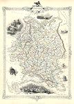
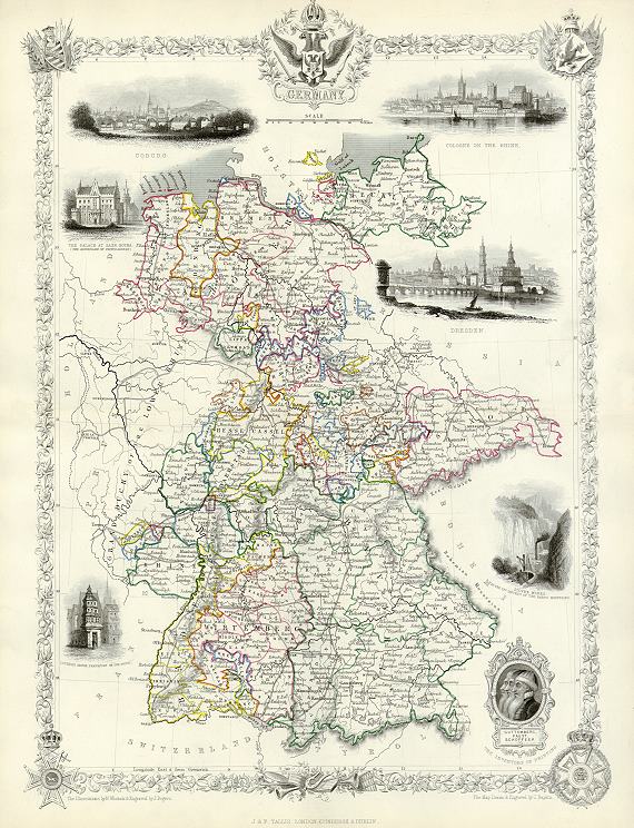
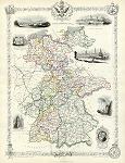 "Germany" drawn and engraved by J.Rapkin, published in Tallis's illustrated Atlas ..., 1851. The original is a detailed steel engraved map with original hand colouring. Click
here for detail showing part of the map at full resolution (600 dpi). Click the small image
to the left for a larger low resolution version. (Ref sm0178). Digital
image size 43 mb at 600 dpi. "Germany" drawn and engraved by J.Rapkin, published in Tallis's illustrated Atlas ..., 1851. The original is a detailed steel engraved map with original hand colouring. Click
here for detail showing part of the map at full resolution (600 dpi). Click the small image
to the left for a larger low resolution version. (Ref sm0178). Digital
image size 43 mb at 600 dpi.
Price 5
USD, Click here to buy
Also available as a photo or giclee print here on Mapseeker
 "An Accurate Map of the Circle of Franconia, Drawn from the best Authorities" (Germany, including Nuremberg and Würzburg) copper engraved antique map, published in Fenning's A New System of Geography ..., 1773. The original is a copper engraved map
with recent hand colouring, measuring 29 x 19.5 cms plus margins. Click
here for detail showing part
of the map at full resolution (400 dpi). Click the small image to the left for a larger low resolution version. (Ref sm0236). Digital image
14.3mb at 400dpi. "An Accurate Map of the Circle of Franconia, Drawn from the best Authorities" (Germany, including Nuremberg and Würzburg) copper engraved antique map, published in Fenning's A New System of Geography ..., 1773. The original is a copper engraved map
with recent hand colouring, measuring 29 x 19.5 cms plus margins. Click
here for detail showing part
of the map at full resolution (400 dpi). Click the small image to the left for a larger low resolution version. (Ref sm0236). Digital image
14.3mb at 400dpi.
Price 5 USD, Click here to buy
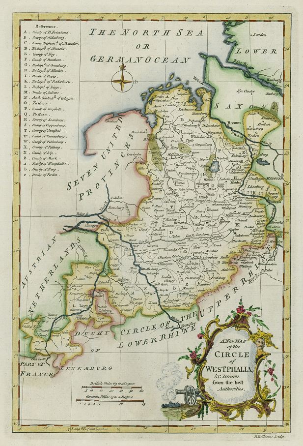
 "A New Map of the Circle of Westphalia, &c. Drawn from the Best Authorities" copper engraved antique map by B.Williams, published in Fenning's A New System of Geography ..., 1773. The original is a copper engraved map
with recent hand colouring, measuring 19 x 28.5 cms plus margins. Click
here for detail showing part
of the map at full resolution (400 dpi). Click the small image to the left for a larger low resolution version. (Ref sm0241). Digital image
13.4mb at 400dpi. "A New Map of the Circle of Westphalia, &c. Drawn from the Best Authorities" copper engraved antique map by B.Williams, published in Fenning's A New System of Geography ..., 1773. The original is a copper engraved map
with recent hand colouring, measuring 19 x 28.5 cms plus margins. Click
here for detail showing part
of the map at full resolution (400 dpi). Click the small image to the left for a larger low resolution version. (Ref sm0241). Digital image
13.4mb at 400dpi.
Price 5 USD, Click here to buy
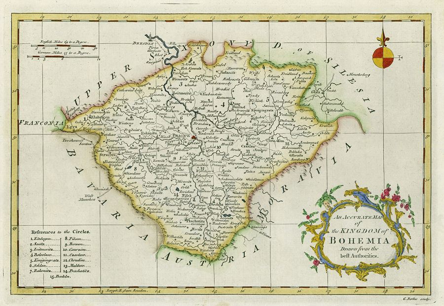
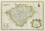 "An Accurate Map of the Kingdom of Bohemia. Drawn from the best Authorities" copper engraved antique map by B.G.Rollos, published in Fenning's A New System of Geography ..., 1773. The original is a copper engraved map
with recent hand colouring, measuring 28.5 x 19 cms plus margins. Click
here for detail showing part
of the map at full resolution (400 dpi). Click the small image to the left for a larger low resolution version. (Ref sm0272). Digital image
13.7mb at 400dpi. "An Accurate Map of the Kingdom of Bohemia. Drawn from the best Authorities" copper engraved antique map by B.G.Rollos, published in Fenning's A New System of Geography ..., 1773. The original is a copper engraved map
with recent hand colouring, measuring 28.5 x 19 cms plus margins. Click
here for detail showing part
of the map at full resolution (400 dpi). Click the small image to the left for a larger low resolution version. (Ref sm0272). Digital image
13.7mb at 400dpi.
Price 5 USD, Click here to buy
_tn.jpg) "Austria archiducatus" (historical map of Upper Austria) published in Mercator's Atlas Minor, about 1630-1636. The original is an antique copper engraved map with
original hand colouring. Click
here for detail showing the Vienna area at full resolution (500 dpi). Click the small image
to the left for a larger low resolution version. (Ref sm0041). Digital
image size 14.5 mb at 500 dpi. "Austria archiducatus" (historical map of Upper Austria) published in Mercator's Atlas Minor, about 1630-1636. The original is an antique copper engraved map with
original hand colouring. Click
here for detail showing the Vienna area at full resolution (500 dpi). Click the small image
to the left for a larger low resolution version. (Ref sm0041). Digital
image size 14.5 mb at 500 dpi.
Price 5
USD, Click here to buy
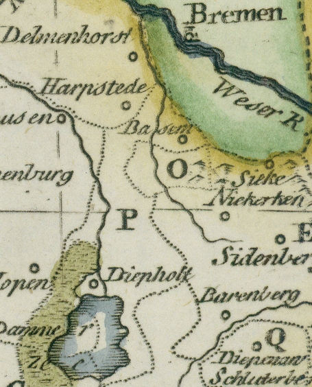
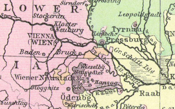
_tn.jpg) "Austria-Hungary"
by J.Bartholomew. The original is a colour lithographic map published in The
Popular Atlas of the World, 1887, measuring 41 x 29 cms plus margins.
Click
here for detail showing part of the map at full resolution (400 dpi). Click the small image
to the left for a larger low resolution version. (Ref sm0275). Digital
image size 28.5 mb at 400 dpi. "Austria-Hungary"
by J.Bartholomew. The original is a colour lithographic map published in The
Popular Atlas of the World, 1887, measuring 41 x 29 cms plus margins.
Click
here for detail showing part of the map at full resolution (400 dpi). Click the small image
to the left for a larger low resolution version. (Ref sm0275). Digital
image size 28.5 mb at 400 dpi.
Price 5
USD, Click here to buy
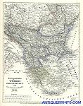
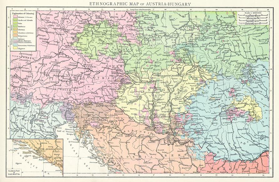
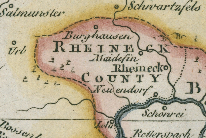
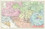 "Ethnographic Map of Austria-Hungary" the original is a colour lithographic map published in The Times Atlas, 1895, measuring about 37 x 24 cms plus margins. Click
here for detail showing part of the map at full resolution (300 dpi). Click the small image
to the left for a larger low resolution version. (Ref sm0257). Digital
image size 11 mb at 300 dpi. "Ethnographic Map of Austria-Hungary" the original is a colour lithographic map published in The Times Atlas, 1895, measuring about 37 x 24 cms plus margins. Click
here for detail showing part of the map at full resolution (300 dpi). Click the small image
to the left for a larger low resolution version. (Ref sm0257). Digital
image size 11 mb at 300 dpi.
Price 5
USD, Click here to buy
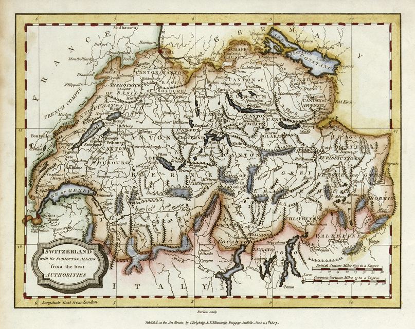
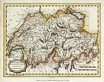 "Switzerland with it's Subjects & Allies from the best Authorities" engraved by Barlow, published in the Rev. E. Blomfield's Geography, 1807. The original is a copper engraved map with
original hand colouring. Click
here for detail showing part
of the map at full resolution (400 dpi). Click the small image
to the left for a larger low resolution version. (Ref sm0247). Digital
image size 9.4 mb at 400 dpi. "Switzerland with it's Subjects & Allies from the best Authorities" engraved by Barlow, published in the Rev. E. Blomfield's Geography, 1807. The original is a copper engraved map with
original hand colouring. Click
here for detail showing part
of the map at full resolution (400 dpi). Click the small image
to the left for a larger low resolution version. (Ref sm0247). Digital
image size 9.4 mb at 400 dpi.
Price 5
USD, Click here to buy
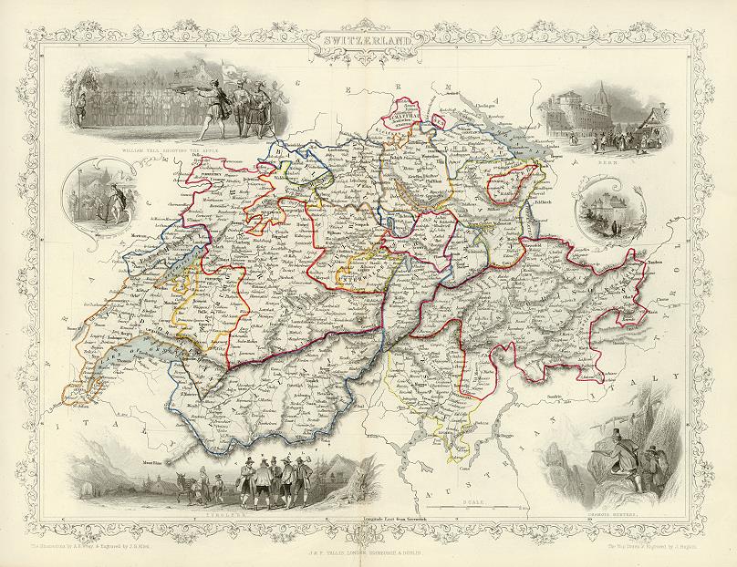
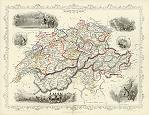 "Switzerland" drawn and engraved by J.Rapkin, published in Tallis's illustrated Atlas ..., 1851. The original is a detailed steel engraved map with original hand colouring and a centrefold which is visible on the image. Click
here for detail showing the Zurich area at full resolution (600 dpi). Click the small image
to the left for a larger low resolution version. (Ref sm0061). Digital
image size 35.5 mb at 600 dpi. "Switzerland" drawn and engraved by J.Rapkin, published in Tallis's illustrated Atlas ..., 1851. The original is a detailed steel engraved map with original hand colouring and a centrefold which is visible on the image. Click
here for detail showing the Zurich area at full resolution (600 dpi). Click the small image
to the left for a larger low resolution version. (Ref sm0061). Digital
image size 35.5 mb at 600 dpi.
Price 5
USD, Click here to buy
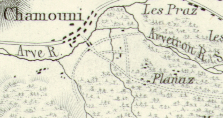
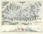 Switzerland "Illustration of the Galcier Systems of the Alps (Mt. Blanc)" by A.K.Johnston, engraved by W. & A.K. Johnston, published in The Physical Atlas of Natural Phenomena, 1850. The original is a steel engraved map with original hand colouring. Click
here for detail showing part of the map at full resolution (600 dpi). Click the small image
to the left for a larger low resolution version. (Ref sm0125). Digital
image size 24mb at 600 dpi. Switzerland "Illustration of the Galcier Systems of the Alps (Mt. Blanc)" by A.K.Johnston, engraved by W. & A.K. Johnston, published in The Physical Atlas of Natural Phenomena, 1850. The original is a steel engraved map with original hand colouring. Click
here for detail showing part of the map at full resolution (600 dpi). Click the small image
to the left for a larger low resolution version. (Ref sm0125). Digital
image size 24mb at 600 dpi.
Price 5
USD, Click here to buy
_tn.jpg) "Italy, Turkey in Europe, Greece, Servia, Roumania &c." by J.Bartholomew F.R.G.S, published in The Popular Atlas of the World, 1885. The original is a colour lithographic map. Click
here for detail showing part
of the map at full resolution (300 dpi). Click the small image to the left for a larger low resolution version. (Ref sm0176). Digital image
17.7mb at 300dpi. "Italy, Turkey in Europe, Greece, Servia, Roumania &c." by J.Bartholomew F.R.G.S, published in The Popular Atlas of the World, 1885. The original is a colour lithographic map. Click
here for detail showing part
of the map at full resolution (300 dpi). Click the small image to the left for a larger low resolution version. (Ref sm0176). Digital image
17.7mb at 300dpi.
Price 5 USD, Click here to buy
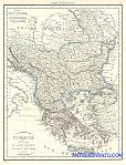
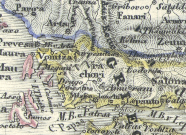
_tn.jpg) "Die Europ. Turkee. Croatien, Herzogovian, Serbien, Bosnien and das Land der Montenegriner. 1857" (Turkey in Europe - Croatia, Herzegovia, Serbia, Bosnia and Montenegro) published in his Illustrationen zu Meyer's Neuem Konversations-Lexicon, 1860. The original is a very detailed steel engraved map with
original hand colouring. Small inset plans of the Belgrade and Sarajevo areas. Click
here for detail showing part
of the map at full resolution (500 dpi). Click the small image
to the left for a larger low resolution version. (Ref sm0047). Digital
image size 16 mb at 500 dpi. "Die Europ. Turkee. Croatien, Herzogovian, Serbien, Bosnien and das Land der Montenegriner. 1857" (Turkey in Europe - Croatia, Herzegovia, Serbia, Bosnia and Montenegro) published in his Illustrationen zu Meyer's Neuem Konversations-Lexicon, 1860. The original is a very detailed steel engraved map with
original hand colouring. Small inset plans of the Belgrade and Sarajevo areas. Click
here for detail showing part
of the map at full resolution (500 dpi). Click the small image
to the left for a larger low resolution version. (Ref sm0047). Digital
image size 16 mb at 500 dpi.
Price 5
USD, Click here to buy
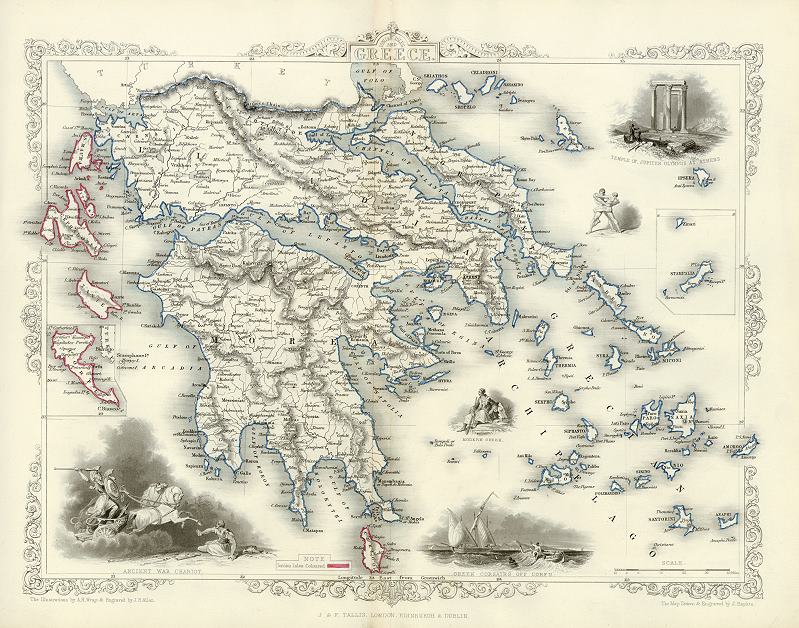
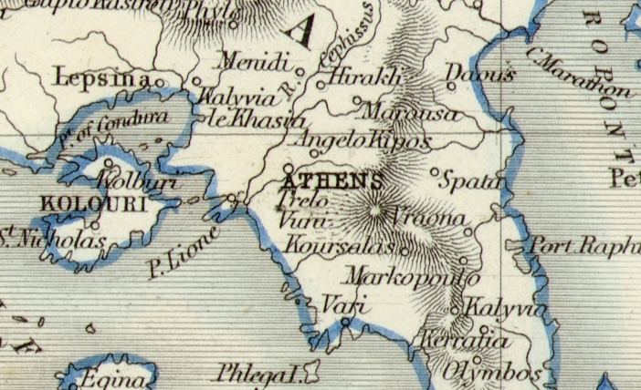
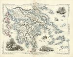 "Greece" drawn and engraved by J.Rapkin, published in Tallis's illustrated Atlas ..., 1851. The original is a decorative steel engraved map with original
hand colouring, including red highlights to the Ionian Islands, there is a centrefold which is visible on the image.. Click
here for detail showing part
of the map at full resolution (400 dpi). Click the small image to the left for a larger low resolution version. (Ref sm0169). Digital image
16.3mb at 400dpi. "Greece" drawn and engraved by J.Rapkin, published in Tallis's illustrated Atlas ..., 1851. The original is a decorative steel engraved map with original
hand colouring, including red highlights to the Ionian Islands, there is a centrefold which is visible on the image.. Click
here for detail showing part
of the map at full resolution (400 dpi). Click the small image to the left for a larger low resolution version. (Ref sm0169). Digital image
16.3mb at 400dpi.
Price 5 USD, Click here to buy
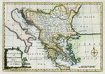
_tn.jpg) "Hungary with Turkey in Europe" (Balkans) by Thomas Jefferys, published in A New Geographical and Historical Grammar, 1772. The original is a copper engraved map
with recent hand colouring, measuring 22 x 18 cms plus margins. Click
here for detail showing part
of the map at full resolution (400 dpi). Click the small image to the left for a larger low resolution version. (Ref sm0089). Digital image
9.5mb at 400dpi. "Hungary with Turkey in Europe" (Balkans) by Thomas Jefferys, published in A New Geographical and Historical Grammar, 1772. The original is a copper engraved map
with recent hand colouring, measuring 22 x 18 cms plus margins. Click
here for detail showing part
of the map at full resolution (400 dpi). Click the small image to the left for a larger low resolution version. (Ref sm0089). Digital image
9.5mb at 400dpi.
Price 5 USD, Click here to buy
 "An Accurate Map of Turkey in Europe from the best Authorities by J.Gibson" (Greece & the Balkans) copper engraved antique map, published in Fenning's A New System of Geography ..., 1773. The original is a copper engraved map
with recent hand colouring, measuring 27 x 18.5 cms plus margins. Click
here for detail showing part
of the map at full resolution (400 dpi). Click the small image to the left for a larger low resolution version. (Ref sm0231). Digital image
13mb at 400dpi. "An Accurate Map of Turkey in Europe from the best Authorities by J.Gibson" (Greece & the Balkans) copper engraved antique map, published in Fenning's A New System of Geography ..., 1773. The original is a copper engraved map
with recent hand colouring, measuring 27 x 18.5 cms plus margins. Click
here for detail showing part
of the map at full resolution (400 dpi). Click the small image to the left for a larger low resolution version. (Ref sm0231). Digital image
13mb at 400dpi.
Price 5 USD, Click here to buy
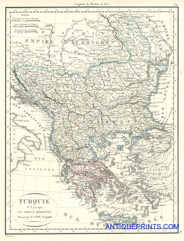
 Turkey in Europe (including Greece, Macedonia, Albania, Bulgaria and Romania) "Turquie d'Europe et Grece Modern" (Balkans) engraved by Chamouin after P.Lapie, published in Lapie's Atlas Classique et Universel, 1815. The original is a copper engraved map
with original hand colouring, measuring 22.5 x 29.5 cms plus margins. Click
here for detail showing part
of the map at full resolution (400 dpi). Click the small image to the left for a larger low resolution version. (Ref sm0214). Digital image
16mb at 400dpi. Turkey in Europe (including Greece, Macedonia, Albania, Bulgaria and Romania) "Turquie d'Europe et Grece Modern" (Balkans) engraved by Chamouin after P.Lapie, published in Lapie's Atlas Classique et Universel, 1815. The original is a copper engraved map
with original hand colouring, measuring 22.5 x 29.5 cms plus margins. Click
here for detail showing part
of the map at full resolution (400 dpi). Click the small image to the left for a larger low resolution version. (Ref sm0214). Digital image
16mb at 400dpi.
Price 5 USD, Click here to buy
 Turkey in Europe (including Greece, Macedonia, Albania, Bulgaria and Romania) "Europaeische Turkey, Griechenland und die Jonischen Inseln, 1850" (Balkans) by Joseph Meyer, published in his Neuster Zeitungs Atlas, 1852. The original is a very detailed steel engraved map
with original hand colouring, measuring 18.5 x 24 cms plus margins. Click
here for detail showing part
of the map at full resolution (500 dpi). Click the small image to the left for a larger low resolution version. (Ref sm0210). Digital image
15mb at 500dpi. Turkey in Europe (including Greece, Macedonia, Albania, Bulgaria and Romania) "Europaeische Turkey, Griechenland und die Jonischen Inseln, 1850" (Balkans) by Joseph Meyer, published in his Neuster Zeitungs Atlas, 1852. The original is a very detailed steel engraved map
with original hand colouring, measuring 18.5 x 24 cms plus margins. Click
here for detail showing part
of the map at full resolution (500 dpi). Click the small image to the left for a larger low resolution version. (Ref sm0210). Digital image
15mb at 500dpi.
Price 5 USD, Click here to buy
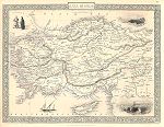
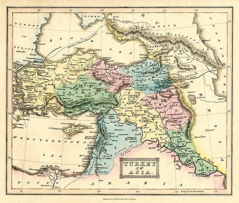
_tn.jpg) "Turkey in Asia " by Thomas Jefferys, published in A New Geographical and Historical Grammar, 1772. The original is a copper engraved map
with recent hand colouring, measuring 24 x 18 cms plus margins. Click
here for detail showing part
of the map at full resolution (400 dpi). Click the small image to the left for a larger low resolution version. (Ref sm0090). Digital image
9.5mb at 400dpi. "Turkey in Asia " by Thomas Jefferys, published in A New Geographical and Historical Grammar, 1772. The original is a copper engraved map
with recent hand colouring, measuring 24 x 18 cms plus margins. Click
here for detail showing part
of the map at full resolution (400 dpi). Click the small image to the left for a larger low resolution version. (Ref sm0090). Digital image
9.5mb at 400dpi.
Price 5 USD, Click here to buy
_tn.jpg) "Turkey in Asia, drawn from the most respectable Authorities" published in his Cooke's Geography, 1817. The original is a copper engraved map with
later hand colouring. Click
here for detail showing the Constantinople area at full resolution (500 dpi). Click the small image
to the left for a larger low resolution version. (Ref sm0074). Digital
image size 19 mb at 500 dpi. "Turkey in Asia, drawn from the most respectable Authorities" published in his Cooke's Geography, 1817. The original is a copper engraved map with
later hand colouring. Click
here for detail showing the Constantinople area at full resolution (500 dpi). Click the small image
to the left for a larger low resolution version. (Ref sm0074). Digital
image size 19 mb at 500 dpi.
Price 5
USD, Click here to buy
 "Turkey in Asia" the original is a lithographic map with original hand colouring, published by Oliver & Boyd in Ewing's New General Atlas, about 1847. Original size 22 x 18 cms, plus margins. Click
here for detail showing part of the map at full resolution (400 dpi). Click the small image
to the left for a larger low resolution version. (Ref sm0245). Digital
image size 10.7 mb at 400 dpi. "Turkey in Asia" the original is a lithographic map with original hand colouring, published by Oliver & Boyd in Ewing's New General Atlas, about 1847. Original size 22 x 18 cms, plus margins. Click
here for detail showing part of the map at full resolution (400 dpi). Click the small image
to the left for a larger low resolution version. (Ref sm0245). Digital
image size 10.7 mb at 400 dpi.
Price 5
USD, Click here to buy
 "Asia Minor" drawn and engraved by J.Rapkin, published by The London Printing and Publishing Company, about 1853. The original is a decorative steel engraved map with original
hand colouring. Click
here for detail showing part
of the map at full resolution (400 dpi). Click the small image to the left for a larger low resolution version. (Ref sm0194). Digital image
19.6mb at 400dpi. "Asia Minor" drawn and engraved by J.Rapkin, published by The London Printing and Publishing Company, about 1853. The original is a decorative steel engraved map with original
hand colouring. Click
here for detail showing part
of the map at full resolution (400 dpi). Click the small image to the left for a larger low resolution version. (Ref sm0194). Digital image
19.6mb at 400dpi.
Price 5 USD, Click here to buy
|
|

.jpg)
.jpg)

.jpg)
.jpg)
.jpg)
.jpg)
.jpg)
.jpg)

.jpg)
.jpg)

.jpg)
-l.jpg)

.jpg)
.jpg)
.jpg)


.jpg)
-l.jpg)

-d.jpg)
-d.jpg)
-d.jpg)
-d.jpg)
-d.jpg)
-d.jpg)
-d.jpg)
-d.jpg)
-d.jpg)
-d.jpg)
-d.jpg)
-d.jpg)
-d.jpg)
-d.jpg)
-d.jpg)
-d.jpg)
-d.jpg)