Download Royalty-free Stock Images of antique regional and county maps of the British Isles
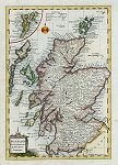 "Scotland, from the Best Authorities, by Thos. Kitchin, Geographer " engraved by G.Rollos, published in
Fenning's A New System of Geography ..., 1773. The original is a copper engraved map
with recent hand colouring, measuring 18.5 x 27 cms, plus margins. Click here for detail showing part
of the map at full resolution (400 dpi). Click the small image
to the left for a larger low resolution version. (Ref sm0233). Digital image
14.2mb at 400dpi. "Scotland, from the Best Authorities, by Thos. Kitchin, Geographer " engraved by G.Rollos, published in
Fenning's A New System of Geography ..., 1773. The original is a copper engraved map
with recent hand colouring, measuring 18.5 x 27 cms, plus margins. Click here for detail showing part
of the map at full resolution (400 dpi). Click the small image
to the left for a larger low resolution version. (Ref sm0233). Digital image
14.2mb at 400dpi.
Price 5 USD, Click here to buy
_tn.jpg) "A New Map of South Wales, drawn from the Latest Authorities" by Thomas Kitchin, published in Picturesque Views of the Antiquities of England & Wales, 1786. The original is a very decorative copper engraved map with
recent hand colouring. Click
here for detail showing part
of the map (Swansea area) at full resolution (600 dpi). Click the small image
to the left for a larger low resolution version. (Ref sm0116). Digital
image size 29.3mb at 600 dpi. "A New Map of South Wales, drawn from the Latest Authorities" by Thomas Kitchin, published in Picturesque Views of the Antiquities of England & Wales, 1786. The original is a very decorative copper engraved map with
recent hand colouring. Click
here for detail showing part
of the map (Swansea area) at full resolution (600 dpi). Click the small image
to the left for a larger low resolution version. (Ref sm0116). Digital
image size 29.3mb at 600 dpi.
Price 5
USD, Click here to buy
_tn.jpg) "A New and Correct Map of North Wales, drawn from the Best Authorities" by Thomas Kitchin, published in Picturesque Views of the Antiquities of England & Wales, 1786. The original is a very decorative copper engraved map with
recent hand colouring. Click
here for detail showing part
of the map (Harlech area) at full resolution (600 dpi). Click the small image
to the left for a larger low resolution version. (Ref sm0117). Digital
image size 28.2mb at 600 dpi. "A New and Correct Map of North Wales, drawn from the Best Authorities" by Thomas Kitchin, published in Picturesque Views of the Antiquities of England & Wales, 1786. The original is a very decorative copper engraved map with
recent hand colouring. Click
here for detail showing part
of the map (Harlech area) at full resolution (600 dpi). Click the small image
to the left for a larger low resolution version. (Ref sm0117). Digital
image size 28.2mb at 600 dpi.
Price 5
USD, Click here to buy
_tn.jpg) "Bedfordshire" engraved by J.Bingley(?), published in Thomas Moule's English Counties ..., 1837. The original is a steel engraved county map with
original hand colouring and measures about 20 x 27 cms. Click
here for detail showing the Bedford area at full resolution (400 dpi). Click the small image
to the left for a larger low resolution version. (Ref sm0099). Digital
image size 12 mb at 600 dpi. "Bedfordshire" engraved by J.Bingley(?), published in Thomas Moule's English Counties ..., 1837. The original is a steel engraved county map with
original hand colouring and measures about 20 x 27 cms. Click
here for detail showing the Bedford area at full resolution (400 dpi). Click the small image
to the left for a larger low resolution version. (Ref sm0099). Digital
image size 12 mb at 600 dpi.
Price 5
USD, Click here to buy
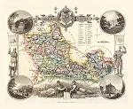 "Berkshire" engraved by J.Bingley, published in Thomas Moule's English Counties ..., 1837. The original is a steel engraved county map with
original hand colouring and measures about 27 x 20 cms. Click
here for detail showing the Reading area at full resolution (600 dpi). Click the small image
to the left for a larger low resolution version. (Ref sm0109). Digital
image size 55 mb at 600 dpi. "Berkshire" engraved by J.Bingley, published in Thomas Moule's English Counties ..., 1837. The original is a steel engraved county map with
original hand colouring and measures about 27 x 20 cms. Click
here for detail showing the Reading area at full resolution (600 dpi). Click the small image
to the left for a larger low resolution version. (Ref sm0109). Digital
image size 55 mb at 600 dpi.
Price 5
USD, Click here to buy
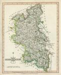 "Buckinghamshire" engraved by John Cary and published in Cary's New and Correct English Atlas, 1809. The original is a copper engraved county map with
original hand colouring and measures about 21.5 x 26.5 cms. Click
here for detail showing the Buckingham area at full resolution (500 dpi). Click the small image
to the left for a larger low resolution version. (Ref sm0261). Digital
image size 18.7 mb at 500 dpi. "Buckinghamshire" engraved by John Cary and published in Cary's New and Correct English Atlas, 1809. The original is a copper engraved county map with
original hand colouring and measures about 21.5 x 26.5 cms. Click
here for detail showing the Buckingham area at full resolution (500 dpi). Click the small image
to the left for a larger low resolution version. (Ref sm0261). Digital
image size 18.7 mb at 500 dpi.
Price 5
USD, Click here to buy
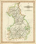 "Cambridgeshire" engraved by John Cary and published in Cary's New and Correct English Atlas, 1809. The original is a copper engraved county map with
original hand colouring and measures about 21 x 26 cms. Click
here for detail showing part of the map at full resolution (600 dpi). Click the small image
to the left for a larger low resolution version. (Ref sm0269). Digital
image size 24.1 mb at 600 dpi. "Cambridgeshire" engraved by John Cary and published in Cary's New and Correct English Atlas, 1809. The original is a copper engraved county map with
original hand colouring and measures about 21 x 26 cms. Click
here for detail showing part of the map at full resolution (600 dpi). Click the small image
to the left for a larger low resolution version. (Ref sm0269). Digital
image size 24.1 mb at 600 dpi.
Price 5
USD, Click here to buy
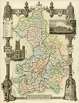 "Cambridgeshire" engraved by W.Schmollinger, published in Thomas Moule's English Counties ..., 1837. The original is a steel engraved county map with
original hand colouring and measures about 19 x 26 cms. Click
here for detail showing the Cambridge area at full resolution (600 dpi). Click the small image
to the left for a larger low resolution version. (Ref sm0101). Digital
image size 21 mb at 600 dpi. "Cambridgeshire" engraved by W.Schmollinger, published in Thomas Moule's English Counties ..., 1837. The original is a steel engraved county map with
original hand colouring and measures about 19 x 26 cms. Click
here for detail showing the Cambridge area at full resolution (600 dpi). Click the small image
to the left for a larger low resolution version. (Ref sm0101). Digital
image size 21 mb at 600 dpi.
Price 5
USD, Click here to buy
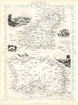 "Channel Islands" (Jersey & Guernsey, Tallis map) drawn and engraved by J.Rapkin, published by The London Printing and Publishing Company, about 1853. The original is a steel engraved map with original
hand colouring. Click
here for detail showing part
of the map at full resolution (400 dpi). Click the small image to the left for a larger low resolution version. (Ref sm0161). Digital image
18.8mb at 400dpi. "Channel Islands" (Jersey & Guernsey, Tallis map) drawn and engraved by J.Rapkin, published by The London Printing and Publishing Company, about 1853. The original is a steel engraved map with original
hand colouring. Click
here for detail showing part
of the map at full resolution (400 dpi). Click the small image to the left for a larger low resolution version. (Ref sm0161). Digital image
18.8mb at 400dpi.
Price 5 USD, Click here to buy
_tn.jpg) "Cheshire" engraved by W.Schmollinger, published in Thomas Moule's English Counties ..., 1837. The original is a steel engraved county map with
original hand colouring. (The original has some mild foxing which is visible on this download, but could be removed digitally.) Click
here for detail showing the Chester area at full resolution (600 dpi). Click the small image
to the left for a larger low resolution version. (Ref sm0104). Digital
image size 22.5 mb at 600 dpi. "Cheshire" engraved by W.Schmollinger, published in Thomas Moule's English Counties ..., 1837. The original is a steel engraved county map with
original hand colouring. (The original has some mild foxing which is visible on this download, but could be removed digitally.) Click
here for detail showing the Chester area at full resolution (600 dpi). Click the small image
to the left for a larger low resolution version. (Ref sm0104). Digital
image size 22.5 mb at 600 dpi.
Price 5
USD, Click here to buy
_tn.jpg) "Cornwall" anonymous engraver, published in Thomas Moule's English Counties ..., 1837. The original is a steel engraved county map with
original hand colouring. Click
here for detail showing the Truro area at full resolution (500 dpi). Click the small image
to the left for a larger low resolution version. (Ref sm0110). Digital
image size 16 mb at 500 dpi. "Cornwall" anonymous engraver, published in Thomas Moule's English Counties ..., 1837. The original is a steel engraved county map with
original hand colouring. Click
here for detail showing the Truro area at full resolution (500 dpi). Click the small image
to the left for a larger low resolution version. (Ref sm0110). Digital
image size 16 mb at 500 dpi.
Price 5
USD, Click here to buy
_tn.jpg) "Derbyshire" engraved by John Cary and published in Cary's New and Correct English Atlas, 1809. The original is a copper engraved county map with
original hand colouring and measures about 21.5 x 26.5 cms. Click
here for detail showing the Bakewell area at full resolution (400 dpi). Click the small image
to the left for a larger low resolution version. (Ref sm0094). Digital
image size 12 mb at 400 dpi. "Derbyshire" engraved by John Cary and published in Cary's New and Correct English Atlas, 1809. The original is a copper engraved county map with
original hand colouring and measures about 21.5 x 26.5 cms. Click
here for detail showing the Bakewell area at full resolution (400 dpi). Click the small image
to the left for a larger low resolution version. (Ref sm0094). Digital
image size 12 mb at 400 dpi.
Price 5
USD, Click here to buy
_tn.jpg) "Derbyshire" engraved by J.Bingley, published in Thomas Moule's English Counties ..., 1837. The original is a steel engraved county map with
original hand colouring and measures about 19 x 25 cms. Click
here for detail showing the Derby area at full resolution (600 dpi). Click the small image
to the left for a larger low resolution version. (Ref sm0093). Digital
image size 23 mb at 600 dpi. "Derbyshire" engraved by J.Bingley, published in Thomas Moule's English Counties ..., 1837. The original is a steel engraved county map with
original hand colouring and measures about 19 x 25 cms. Click
here for detail showing the Derby area at full resolution (600 dpi). Click the small image
to the left for a larger low resolution version. (Ref sm0093). Digital
image size 23 mb at 600 dpi.
Price 5
USD, Click here to buy
_tn.jpg) "Devonshire" engraved by J.Dower, published in Thomas Moule's English Counties ..., 1837. The original is a steel engraved county map with
original hand colouring. Click
here for detail showing the Plymouth area at full resolution (500 dpi). Click the small image
to the left for a larger low resolution version. (Ref sm0111). Digital
image size 13.5 mb at 500 dpi. "Devonshire" engraved by J.Dower, published in Thomas Moule's English Counties ..., 1837. The original is a steel engraved county map with
original hand colouring. Click
here for detail showing the Plymouth area at full resolution (500 dpi). Click the small image
to the left for a larger low resolution version. (Ref sm0111). Digital
image size 13.5 mb at 500 dpi.
Price 5
USD, Click here to buy
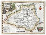 "Durham, drawn from the Best Authorities ..." by Thomas Kitchin, published in Picturesque Views of the Antiquities of England & Wales, 1786. The original is a decorative copper engraved map with
recent hand colouring. Click
here for detail showing part
of the map (500 dpi). Click the small image
to the left for a larger low resolution version. (Ref sm0204). Digital
image size 11.9mb at500 dpi. "Durham, drawn from the Best Authorities ..." by Thomas Kitchin, published in Picturesque Views of the Antiquities of England & Wales, 1786. The original is a decorative copper engraved map with
recent hand colouring. Click
here for detail showing part
of the map (500 dpi). Click the small image
to the left for a larger low resolution version. (Ref sm0204). Digital
image size 11.9mb at500 dpi.
Price 5
USD, Click here to buy
-600_tn.jpg) "Essex" engraved by John Cary and published in Cary's New and Correct English Atlas, 1809. The original is a copper engraved county map with
original hand colouring and measures about 26.5 x 21.5 cms. Click
here for detail showing part of the map at full resolution (600 dpi). Click the small image
to the left for a larger low resolution version. (Ref sm0274). Digital
image size 27.5mb at 600 dpi. "Essex" engraved by John Cary and published in Cary's New and Correct English Atlas, 1809. The original is a copper engraved county map with
original hand colouring and measures about 26.5 x 21.5 cms. Click
here for detail showing part of the map at full resolution (600 dpi). Click the small image
to the left for a larger low resolution version. (Ref sm0274). Digital
image size 27.5mb at 600 dpi.
Price 5
USD, Click here to buy
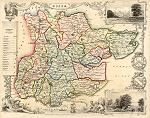 "Essex" engraved by W.Schmollinger, published in Thomas Moule's English Counties ..., 1837. The original is a steel engraved county map with
original hand colouring and measures about 25 x 19 cms. Click
here for detail showing the Chelmsford area at full resolution (800 dpi). Click the small image
to the left for a larger low resolution version. (Ref sm0112). At 800 dpi this is a particularly detailed, but large, image. Digital
image size 72.5 mb at 800 dpi. "Essex" engraved by W.Schmollinger, published in Thomas Moule's English Counties ..., 1837. The original is a steel engraved county map with
original hand colouring and measures about 25 x 19 cms. Click
here for detail showing the Chelmsford area at full resolution (800 dpi). Click the small image
to the left for a larger low resolution version. (Ref sm0112). At 800 dpi this is a particularly detailed, but large, image. Digital
image size 72.5 mb at 800 dpi.
Price 5
USD, Click here to buy
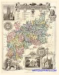 "Gloucestershire" engraved by J.Bingley, published in Thomas Moule's English Counties ..., 1837. The original is a steel engraved county map with
original hand colouring and measures about 19 x 25 cms. Click
here for detail showing the Gloucester area at full resolution (600 dpi). Click the small image
to the left for a larger low resolution version. (Ref sm0134). At 600 dpi this is a very detailed, but large, image. Digital
image size 29.5 mb at 600 dpi. "Gloucestershire" engraved by J.Bingley, published in Thomas Moule's English Counties ..., 1837. The original is a steel engraved county map with
original hand colouring and measures about 19 x 25 cms. Click
here for detail showing the Gloucester area at full resolution (600 dpi). Click the small image
to the left for a larger low resolution version. (Ref sm0134). At 600 dpi this is a very detailed, but large, image. Digital
image size 29.5 mb at 600 dpi.
Price 5
USD, Click here to buy
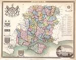 "Hampshire" engraved by J.Dower, published in Thomas Moule's English Counties ..., 1837. The original is a steel engraved county map with
original hand colouring and measures about 25 x 19 cms. Click
here for detail showing the Portsmouth area at full resolution (600 dpi). Click the small image
to the left for a larger low resolution version. (Ref sm0130). At 600 dpi this is a very detailed, but large, image. Digital
image size 24.2 mb at 600 dpi. "Hampshire" engraved by J.Dower, published in Thomas Moule's English Counties ..., 1837. The original is a steel engraved county map with
original hand colouring and measures about 25 x 19 cms. Click
here for detail showing the Portsmouth area at full resolution (600 dpi). Click the small image
to the left for a larger low resolution version. (Ref sm0130). At 600 dpi this is a very detailed, but large, image. Digital
image size 24.2 mb at 600 dpi.
Price 5
USD, Click here to buy
_tn.jpg) "Environs of Portsmouth" (Hampshire) anonymous engraver, published in Thomas Moule's English Counties ..., 1837. The original is a steel engraved map with
recent hand colouring and measures about 25 x 19 cms. Click
here for detail showing part of the map at full resolution (400 dpi). Click the small image
to the left for a larger low resolution version. (Ref sm0135). Digital
image size 10 mb at 400 dpi. "Environs of Portsmouth" (Hampshire) anonymous engraver, published in Thomas Moule's English Counties ..., 1837. The original is a steel engraved map with
recent hand colouring and measures about 25 x 19 cms. Click
here for detail showing part of the map at full resolution (400 dpi). Click the small image
to the left for a larger low resolution version. (Ref sm0135). Digital
image size 10 mb at 400 dpi.
Price 5
USD, Click here to buy
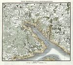 "The Country round Southampton" (Hampshire) anonymous engraver, published in Patterson's Roads ..., 1824. The original is a very detailed copper engraved map with
recent hand colouring and measures about 20.5 x 19 cms. Click
here for detail showing part of the map at full resolution (500 dpi). Click the small image
to the left for a larger low resolution version. (Ref sm0198). Digital
image size 15.4 mb at 500 dpi. "The Country round Southampton" (Hampshire) anonymous engraver, published in Patterson's Roads ..., 1824. The original is a very detailed copper engraved map with
recent hand colouring and measures about 20.5 x 19 cms. Click
here for detail showing part of the map at full resolution (500 dpi). Click the small image
to the left for a larger low resolution version. (Ref sm0198). Digital
image size 15.4 mb at 500 dpi.
Price 5
USD, Click here to buy
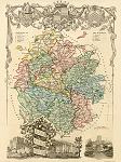 "Herefordshire" engraved by J.Bingley, published in Thomas Moule's English Counties ..., 1837. The original is a steel engraved county map with
original hand colouring. Click
here for detail showing the Hereford area at full resolution (600 dpi). Click the small image
to the left for a larger low resolution version. (Ref sm0148). Digital
image size 23.5 mb at 600 dpi. "Herefordshire" engraved by J.Bingley, published in Thomas Moule's English Counties ..., 1837. The original is a steel engraved county map with
original hand colouring. Click
here for detail showing the Hereford area at full resolution (600 dpi). Click the small image
to the left for a larger low resolution version. (Ref sm0148). Digital
image size 23.5 mb at 600 dpi.
Price 5
USD, Click here to buy
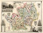 "Hertfordshire" engraved by W.Schmollinger, published in Thomas Moule's English Counties ..., 1837. The original is a steel engraved county map with
original hand colouring. Click
here for detail showing the Watford area at full resolution (600 dpi). Click the small image
to the left for a larger low resolution version. (Ref sm0144). Digital
image size 23.6 mb at 600 dpi. "Hertfordshire" engraved by W.Schmollinger, published in Thomas Moule's English Counties ..., 1837. The original is a steel engraved county map with
original hand colouring. Click
here for detail showing the Watford area at full resolution (600 dpi). Click the small image
to the left for a larger low resolution version. (Ref sm0144). Digital
image size 23.6 mb at 600 dpi.
Price 5
USD, Click here to buy
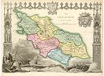 "Isle of Man" engraved by J.Bingley, published in Thomas Moule's English Counties ..., 1837 (dated 1833). The original is a steel engraved county map with
original hand colouring. Click
here for detail showing part of the map at full resolution (600 dpi). Click the small image
to the left for a larger low resolution version. (Ref sm0138). Digital
image size 23.5 mb at 600 dpi. "Isle of Man" engraved by J.Bingley, published in Thomas Moule's English Counties ..., 1837 (dated 1833). The original is a steel engraved county map with
original hand colouring. Click
here for detail showing part of the map at full resolution (600 dpi). Click the small image
to the left for a larger low resolution version. (Ref sm0138). Digital
image size 23.5 mb at 600 dpi.
Price 5
USD, Click here to buy
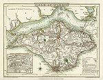 "Isle of Wight" engraved by J.Roper after a map by G.Cole, published in The Beauties of England & Wales, 1806. The original is a copper engraved map with
original hand colouring. Click
here for detail showing part of the map at full resolution (500 dpi). Click the small image
to the left for a larger low resolution version. (Ref sm0265). Digital
image size 14.8 mb at 500 dpi. "Isle of Wight" engraved by J.Roper after a map by G.Cole, published in The Beauties of England & Wales, 1806. The original is a copper engraved map with
original hand colouring. Click
here for detail showing part of the map at full resolution (500 dpi). Click the small image
to the left for a larger low resolution version. (Ref sm0265). Digital
image size 14.8 mb at 500 dpi.
Price 5
USD, Click here to buy
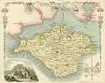 "Isle of Wight" anonymous engraver, published in Thomas Moule's English Counties ..., 1837 (dated 1833). The original is a steel engraved county map with
original hand colouring. Click
here for detail showing part of the map at full resolution (600 dpi). Click the small image
to the left for a larger low resolution version. (Ref sm0140). Digital
image size 20.5 mb at 600 dpi. "Isle of Wight" anonymous engraver, published in Thomas Moule's English Counties ..., 1837 (dated 1833). The original is a steel engraved county map with
original hand colouring. Click
here for detail showing part of the map at full resolution (600 dpi). Click the small image
to the left for a larger low resolution version. (Ref sm0140). Digital
image size 20.5 mb at 600 dpi.
Price 5
USD, Click here to buy
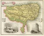 "Isle of Thanet" (Kent) engraved by I.Dower, published in Thomas Moule's English Counties ..., 1837 (dated 1833). The original is a steel engraved map with
original hand colouring. Click
here for detail showing part of the map at full resolution (500 dpi). Click the small image
to the left for a larger low resolution version. (Ref sm0140). Digital
image size 14.2 mb at 500 dpi. "Isle of Thanet" (Kent) engraved by I.Dower, published in Thomas Moule's English Counties ..., 1837 (dated 1833). The original is a steel engraved map with
original hand colouring. Click
here for detail showing part of the map at full resolution (500 dpi). Click the small image
to the left for a larger low resolution version. (Ref sm0140). Digital
image size 14.2 mb at 500 dpi.
Price 5
USD, Click here to buy
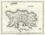 "Jersey" (Channel Islands) engraved by J. & C. Walker after R.Creighton, published in Lewis' Topographical Dictionary, 1848. The original is a steel engraved map with
original hand colour, measuring 23 x 18 cms. Click
here for detail showing part of the map at full resolution (500 dpi). Click the small image
to the left for a larger low resolution version. (Ref sm0212). Digital
image size 11.7 mb at 500 dpi. "Jersey" (Channel Islands) engraved by J. & C. Walker after R.Creighton, published in Lewis' Topographical Dictionary, 1848. The original is a steel engraved map with
original hand colour, measuring 23 x 18 cms. Click
here for detail showing part of the map at full resolution (500 dpi). Click the small image
to the left for a larger low resolution version. (Ref sm0212). Digital
image size 11.7 mb at 500 dpi.
Price 5
USD, Click here to buy
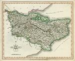 "Kent" engraved by John Cary and published in Cary's New and Correct English Atlas, 1809. The original is a copper engraved county map with
original hand colouring and measures about 26.5 x 21.5 cms. Click
here for detail showing the Maidstone area at full resolution (500 dpi). Click the small image
to the left for a larger low resolution version. (Ref sm0219). Digital
image size 16.3mb at 500 dpi. "Kent" engraved by John Cary and published in Cary's New and Correct English Atlas, 1809. The original is a copper engraved county map with
original hand colouring and measures about 26.5 x 21.5 cms. Click
here for detail showing the Maidstone area at full resolution (500 dpi). Click the small image
to the left for a larger low resolution version. (Ref sm0219). Digital
image size 16.3mb at 500 dpi.
Price 5
USD, Click here to buy
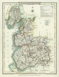 "Lancashire" engraved by J.Roper after a map by G.Cole, published in The Beauties of England & Wales, 1807. The original is a copper engraved map with
original hand colouring.
Click
here for detail showing part of the map at full resolution (500 dpi). Click the small image
to the left for a larger low resolution version. (Ref sm0277). Digital
image size 10.8 mb at 500 dpi. "Lancashire" engraved by J.Roper after a map by G.Cole, published in The Beauties of England & Wales, 1807. The original is a copper engraved map with
original hand colouring.
Click
here for detail showing part of the map at full resolution (500 dpi). Click the small image
to the left for a larger low resolution version. (Ref sm0277). Digital
image size 10.8 mb at 500 dpi.
Price 5
USD, Click here to buy
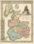 "Lancashire" engraved by W.Schmollinger, published in Thomas Moule's English Counties ..., 1837. The original is a steel engraved county map with
original hand colouring. (The original has some slight foxing on the upper decorative border, which is visible on this download, but could be removed digitally.) Click
here for detail showing the Liverpool area at full resolution (600 dpi). Click the small image
to the left for a larger low resolution version. (Ref sm0120). Digital
image size 26.2 mb at 600 dpi. "Lancashire" engraved by W.Schmollinger, published in Thomas Moule's English Counties ..., 1837. The original is a steel engraved county map with
original hand colouring. (The original has some slight foxing on the upper decorative border, which is visible on this download, but could be removed digitally.) Click
here for detail showing the Liverpool area at full resolution (600 dpi). Click the small image
to the left for a larger low resolution version. (Ref sm0120). Digital
image size 26.2 mb at 600 dpi.
Price 5
USD, Click here to buy
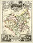 "Leicestershire" engraved by James Bingley, published in Thomas Moule's English Counties ..., 1837. The original is a steel engraved county map with
original hand colouring. Click
here for detail showing the Leicester area at full resolution (500 dpi). Click the small image
to the left for a larger low resolution version. (Ref sm0147). Digital
image size 15.6 mb at 500 dpi. "Leicestershire" engraved by James Bingley, published in Thomas Moule's English Counties ..., 1837. The original is a steel engraved county map with
original hand colouring. Click
here for detail showing the Leicester area at full resolution (500 dpi). Click the small image
to the left for a larger low resolution version. (Ref sm0147). Digital
image size 15.6 mb at 500 dpi.
Price 5
USD, Click here to buy
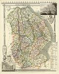 "Lincolnshire" engraved by James Bingley, published in Thomas Moule's English Counties ..., 1837. The original is a steel engraved county map with
original hand colouring. Click
here for detail showing the Lincoln area at full resolution (600 dpi). Click the small image
to the left for a larger low resolution version. (Ref sm0141). Digital
image size 23.4 mb at 600 dpi. "Lincolnshire" engraved by James Bingley, published in Thomas Moule's English Counties ..., 1837. The original is a steel engraved county map with
original hand colouring. Click
here for detail showing the Lincoln area at full resolution (600 dpi). Click the small image
to the left for a larger low resolution version. (Ref sm0141). Digital
image size 23.4 mb at 600 dpi.
Price 5
USD, Click here to buy
_tn.jpg) "Middlesex, drawn from an Accurate Survey..." by Thomas Kitchin, published in Picturesque Views of the Antiquities of England & Wales, 1786. The original is a decorative copper engraved map with
recent hand colouring.
Click
here for detail showing part
of the map (500 dpi). Click the small image
to the left for a larger low resolution version. (Ref sm0279). Digital
image size 10.3mb at500 dpi. "Middlesex, drawn from an Accurate Survey..." by Thomas Kitchin, published in Picturesque Views of the Antiquities of England & Wales, 1786. The original is a decorative copper engraved map with
recent hand colouring.
Click
here for detail showing part
of the map (500 dpi). Click the small image
to the left for a larger low resolution version. (Ref sm0279). Digital
image size 10.3mb at500 dpi.
Price 5
USD, Click here to buy
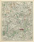 [ Middlesex & London environs ] engraved by John Cary, published in Cary's New Map of England and Wales ..., 1794. The original is a copper engraved map with
original hand colouring. This was published as sheet 25 of Cary's detailed atlas that covered most of Britain. Click
here for detail showing part of the map at full resolution (500 dpi). Click the small image
to the left for a larger low resolution version. (Ref sm0166). Digital
image size 23.2 mb at 500 dpi. [ Middlesex & London environs ] engraved by John Cary, published in Cary's New Map of England and Wales ..., 1794. The original is a copper engraved map with
original hand colouring. This was published as sheet 25 of Cary's detailed atlas that covered most of Britain. Click
here for detail showing part of the map at full resolution (500 dpi). Click the small image
to the left for a larger low resolution version. (Ref sm0166). Digital
image size 23.2 mb at 500 dpi.
Price 5
USD, Click here to buy
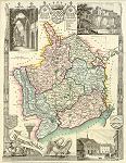 "Monmouthshire" engraved by James Bingley, published in Thomas Moule's English Counties ..., 1837. The original is a steel engraved county map with
original hand colouring. Click
here for detail showing the Monmouth area at full resolution (600 dpi). Click the small image
to the left for a larger low resolution version. (Ref sm0154). Digital
image size 24.3 mb at 600 dpi. "Monmouthshire" engraved by James Bingley, published in Thomas Moule's English Counties ..., 1837. The original is a steel engraved county map with
original hand colouring. Click
here for detail showing the Monmouth area at full resolution (600 dpi). Click the small image
to the left for a larger low resolution version. (Ref sm0154). Digital
image size 24.3 mb at 600 dpi.
Price 5
USD, Click here to buy
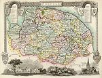 "Norfolk" engraved by W.Schmollinger, published in Thomas Moule's English Counties ..., 1837. The original is a steel engraved county map with
original hand colouring and measures about 25 x 19 cms. Click
here for detail showing the Norwich area at full resolution (500 dpi). Click the small image
to the left for a larger low resolution version. (Ref sm0131). Digital
image size 16.5 mb at 500 dpi. "Norfolk" engraved by W.Schmollinger, published in Thomas Moule's English Counties ..., 1837. The original is a steel engraved county map with
original hand colouring and measures about 25 x 19 cms. Click
here for detail showing the Norwich area at full resolution (500 dpi). Click the small image
to the left for a larger low resolution version. (Ref sm0131). Digital
image size 16.5 mb at 500 dpi.
Price 5
USD, Click here to buy
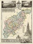 "Northamptonshire" engraved by James Bingley, published in Thomas Moule's English Counties ..., 1837. The original is a steel engraved county map with
original hand colouring and measures about 19 x 25 cms. Click
here for detail showing the Northampton area at full resolution (500 dpi). Click the small image
to the left for a larger low resolution version. (Ref sm0151). Digital
image size 16.8 mb at 500 dpi. "Northamptonshire" engraved by James Bingley, published in Thomas Moule's English Counties ..., 1837. The original is a steel engraved county map with
original hand colouring and measures about 19 x 25 cms. Click
here for detail showing the Northampton area at full resolution (500 dpi). Click the small image
to the left for a larger low resolution version. (Ref sm0151). Digital
image size 16.8 mb at 500 dpi.
Price 5
USD, Click here to buy
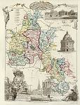 "Oxfordshire" engraved by J.Bingley, published in Thomas Moule's English Counties ..., 1837. The original is a steel engraved county map with
original hand colouring and measures about 19 x 25 cms. Click
here for detail showing the Oxford area at full resolution (600 dpi). Click the small image
to the left for a larger low resolution version. (Ref sm0137). Digital
image size 22.1 mb at 600 dpi. "Oxfordshire" engraved by J.Bingley, published in Thomas Moule's English Counties ..., 1837. The original is a steel engraved county map with
original hand colouring and measures about 19 x 25 cms. Click
here for detail showing the Oxford area at full resolution (600 dpi). Click the small image
to the left for a larger low resolution version. (Ref sm0137). Digital
image size 22.1 mb at 600 dpi.
Price 5
USD, Click here to buy
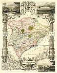 "Rutlandshire" engraved by J.Bingley, published in Thomas Moule's English Counties ..., 1837. The original is a steel engraved county map with
original hand colouring and measures about 19 x 25 cms. Click
here for detail showing the Oakham area at full resolution (500 dpi). Click the small image
to the left for a larger low resolution version. (Ref sm0226). Digital
image size 19 mb at 500 dpi. "Rutlandshire" engraved by J.Bingley, published in Thomas Moule's English Counties ..., 1837. The original is a steel engraved county map with
original hand colouring and measures about 19 x 25 cms. Click
here for detail showing the Oakham area at full resolution (500 dpi). Click the small image
to the left for a larger low resolution version. (Ref sm0226). Digital
image size 19 mb at 500 dpi.
Price 5
USD, Click here to buy
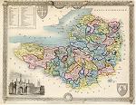 "Somersetshire" engraved by I.Dower, published in Thomas Moule's English Counties ..., 1837. The original is a steel engraved county map with
original hand colouring and measures about 25 x 19 cms. Click
here for detail showing the Bridgewater area at full resolution (600 dpi). NOTE - the original has frayed edges and is slightly trimmed. Click the small image
to the left for a larger low resolution version. (Ref sm0152). Digital
image size 24 mb at 600 dpi. "Somersetshire" engraved by I.Dower, published in Thomas Moule's English Counties ..., 1837. The original is a steel engraved county map with
original hand colouring and measures about 25 x 19 cms. Click
here for detail showing the Bridgewater area at full resolution (600 dpi). NOTE - the original has frayed edges and is slightly trimmed. Click the small image
to the left for a larger low resolution version. (Ref sm0152). Digital
image size 24 mb at 600 dpi.
Price 5
USD, Click here to buy
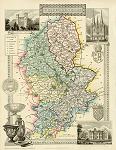 "Staffordshire" engraved by James Bingley, published in Thomas Moule's English Counties ..., 1837. The original is a steel engraved county map with
original hand colouring and measures about 19 x 25 cms. Click
here for detail showing the Stafford area at full resolution (600 dpi). Click the small image
to the left for a larger low resolution version. (Ref sm0153). Digital
image size 22.8 mb at 600 dpi. "Staffordshire" engraved by James Bingley, published in Thomas Moule's English Counties ..., 1837. The original is a steel engraved county map with
original hand colouring and measures about 19 x 25 cms. Click
here for detail showing the Stafford area at full resolution (600 dpi). Click the small image
to the left for a larger low resolution version. (Ref sm0153). Digital
image size 22.8 mb at 600 dpi.
Price 5
USD, Click here to buy
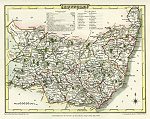 "Suffolk" engraved by John Cary and published in Cary's New and Correct English Atlas, 1809. The original is a copper engraved county map with
original hand colouring and measures about 26 x 21 cms. Click
here for detail showing the Ipswich area at full resolution (500 dpi). Click the small image
to the left for a larger low resolution version. (Ref sm0267). Digital
image size 16.4 mb at 500 dpi. "Suffolk" engraved by John Cary and published in Cary's New and Correct English Atlas, 1809. The original is a copper engraved county map with
original hand colouring and measures about 26 x 21 cms. Click
here for detail showing the Ipswich area at full resolution (500 dpi). Click the small image
to the left for a larger low resolution version. (Ref sm0267). Digital
image size 16.4 mb at 500 dpi.
Price 5
USD, Click here to buy
_tn.jpg) "Surrey, drawn from an Actual Survey..." by Thomas Kitchin, published in Picturesque Views of the Antiquities of England & Wales, 1786. The original is a decorative copper engraved map with
recent hand colouring. Click
here for detail showing part
of the map (500 dpi). Click the small image
to the left for a larger low resolution version. (Ref sm0227). Digital
image size 10.3mb at500 dpi. "Surrey, drawn from an Actual Survey..." by Thomas Kitchin, published in Picturesque Views of the Antiquities of England & Wales, 1786. The original is a decorative copper engraved map with
recent hand colouring. Click
here for detail showing part
of the map (500 dpi). Click the small image
to the left for a larger low resolution version. (Ref sm0227). Digital
image size 10.3mb at500 dpi.
Price 5
USD, Click here to buy
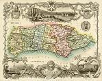 "Sussex" engraved by W.Schmollinger, published in Thomas Moule's English Counties ..., 1837. The original is a steel engraved county map with
original hand colouring and measures about 25 x 19 cms. Click
here for detail showing the Midhurst area at full resolution (600 dpi). Click the small image
to the left for a larger low resolution version. (Ref sm0105). Digital
image size 24 mb at 600 dpi. "Sussex" engraved by W.Schmollinger, published in Thomas Moule's English Counties ..., 1837. The original is a steel engraved county map with
original hand colouring and measures about 25 x 19 cms. Click
here for detail showing the Midhurst area at full resolution (600 dpi). Click the small image
to the left for a larger low resolution version. (Ref sm0105). Digital
image size 24 mb at 600 dpi.
Price 5
USD, Click here to buy
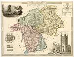 "Westmoreland" anonymous engraver, published in Thomas Moule's English Counties ..., 1837. The original is a steel engraved county map with
original hand colouring. Click
here for detail showing part of the map at full resolution (600 dpi). Click the small image
to the left for a larger low resolution version. (Ref sm0146). Digital
image size 24.4 mb at 600 dpi. "Westmoreland" anonymous engraver, published in Thomas Moule's English Counties ..., 1837. The original is a steel engraved county map with
original hand colouring. Click
here for detail showing part of the map at full resolution (600 dpi). Click the small image
to the left for a larger low resolution version. (Ref sm0146). Digital
image size 24.4 mb at 600 dpi.
Price 5
USD, Click here to buy
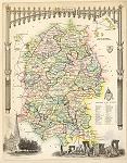 "Wiltshire" engraved by W.Schmollinger, published in Thomas Moule's English Counties ..., 1837. The original is a steel engraved county map with
original hand colouring. Click
here for detail showing the Salisbury area at full resolution (600 dpi). Click the small image
to the left for a larger low resolution version. (Ref sm0143). Digital
image size 24.6 mb at 600 dpi. "Wiltshire" engraved by W.Schmollinger, published in Thomas Moule's English Counties ..., 1837. The original is a steel engraved county map with
original hand colouring. Click
here for detail showing the Salisbury area at full resolution (600 dpi). Click the small image
to the left for a larger low resolution version. (Ref sm0143). Digital
image size 24.6 mb at 600 dpi.
Price 5
USD, Click here to buy
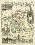 "Worcestershire" engraved by James Bingley, published in Thomas Moule's English Counties ..., 1837. The original is a steel engraved county map with
original hand colouring. Click
here for detail showing the Worcester area at full resolution (600 dpi). Click the small image
to the left for a larger low resolution version. (Ref sm0142). Digital
image size 23.7 mb at 600 dpi. "Worcestershire" engraved by James Bingley, published in Thomas Moule's English Counties ..., 1837. The original is a steel engraved county map with
original hand colouring. Click
here for detail showing the Worcester area at full resolution (600 dpi). Click the small image
to the left for a larger low resolution version. (Ref sm0142). Digital
image size 23.7 mb at 600 dpi.
Price 5
USD, Click here to buy
|

