|
Home
Catalogue
Information
Copyright
Other Stock Image websites

Latest additions -
Athens, ancient ruins, c1775
Pulo Penang, Malaysia, c1840
The Capitol, Washington, 1840
Middlesex county map, 1786
Philadelphia plan (SDUK), 1844
Lancashire county map, 1807
Ireland map, 1773
Austria-Hungary map, 1887
Notre Dame, Paris, 1840
Essex map, 1809
Eastern USA map, 1852
Calcutta view, 1850
Bohemia map, 1773
Dardanelles view, Turkey, 1828
Baltic Sea Tallis map, 1860
Plan of medieval Paris, 1884
Istanbul view, 1770
|
Download Royalty-free Stock Images of historical antique maps of Asia (including China)
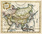 "Asia from the best Authorities By Tho.Kitchin Geo." published in The Modern Gazetteer..., about 1770. The original is a copper engraved map
with recent hand colouring, measuring 18.5 x 15 cms plus margins. Click
here for detail showing part
of the map at full resolution (500 dpi). Click the small image to the left for a larger low resolution version. (Ref sm0189). Digital image
11.1mb at 500dpi. "Asia from the best Authorities By Tho.Kitchin Geo." published in The Modern Gazetteer..., about 1770. The original is a copper engraved map
with recent hand colouring, measuring 18.5 x 15 cms plus margins. Click
here for detail showing part
of the map at full resolution (500 dpi). Click the small image to the left for a larger low resolution version. (Ref sm0189). Digital image
11.1mb at 500dpi.
Price 5 USD, Click here to buy
_tn.jpg) "Asia" by Thomas Jefferys, published in A New Geographical and Historical Grammar, 1772. The original is a copper engraved map
with recent hand colouring, measuring 24.5 x 18 cms plus margins. Click
here for detail showing part
of the map (India) at full resolution (400 dpi). Click the small image to the left for a larger low resolution version. (Ref sm0088). Digital image
10.5mb at 400dpi. "Asia" by Thomas Jefferys, published in A New Geographical and Historical Grammar, 1772. The original is a copper engraved map
with recent hand colouring, measuring 24.5 x 18 cms plus margins. Click
here for detail showing part
of the map (India) at full resolution (400 dpi). Click the small image to the left for a larger low resolution version. (Ref sm0088). Digital image
10.5mb at 400dpi.
Price 5 USD, Click here to buy
_tn.jpg) "Central Asia " engraved by B.Smith, published by C.Smith in Smith's New General Atlas, London, 1816. The original is a copper engraved map
measuring 35.5 x 26.5 cms, with original hand colour. Concentrating on Mongolia, Tibet, Nepal, western China, part of Russia and Kazakhstan. Click
here for detail showing part
of the map at full resolution (500 dpi). Click the small image
to the left for a larger low resolution version. (Ref sm0040). Digital
image size 26.5 mb at 500 dpi. "Central Asia " engraved by B.Smith, published by C.Smith in Smith's New General Atlas, London, 1816. The original is a copper engraved map
measuring 35.5 x 26.5 cms, with original hand colour. Concentrating on Mongolia, Tibet, Nepal, western China, part of Russia and Kazakhstan. Click
here for detail showing part
of the map at full resolution (500 dpi). Click the small image
to the left for a larger low resolution version. (Ref sm0040). Digital
image size 26.5 mb at 500 dpi.
Price 5
USD, Click here to buy
_tn.jpg) "Asia drawn from the latest Astronomical Observations " the original is a copper engraved map (with later hand colouring), measuring 23 x 30 cms, published in Cooke's Geography, 1817. Includes Australia, or 'New Holland' as it is still called on this map. Click
here for detail showing part
of the map (Peking area) at full resolution area) (500 dpi). Click the small image
to the left for a larger low resolution version. NOTE - The original has two flattened folds
which are just visible in the digital version. (Ref sm0076). Digital
image size 21 mb at 500 dpi. "Asia drawn from the latest Astronomical Observations " the original is a copper engraved map (with later hand colouring), measuring 23 x 30 cms, published in Cooke's Geography, 1817. Includes Australia, or 'New Holland' as it is still called on this map. Click
here for detail showing part
of the map (Peking area) at full resolution area) (500 dpi). Click the small image
to the left for a larger low resolution version. NOTE - The original has two flattened folds
which are just visible in the digital version. (Ref sm0076). Digital
image size 21 mb at 500 dpi.
Price 5
USD, Click here to buy
_tn.jpg) "Asia" the original is a steel engraved map with original hand colouring, published in Chambers Atlas for the People, 1846. Click
here for detail showing part
of the map (Afghanistan area) at full resolution area) (500 dpi). This is a relatively plain map of the time, showing the political boundaries in hand colour. Click the small image
to the left for a larger low resolution version. (Ref sm0132). Digital
image size 13.1 mb at 500 dpi. "Asia" the original is a steel engraved map with original hand colouring, published in Chambers Atlas for the People, 1846. Click
here for detail showing part
of the map (Afghanistan area) at full resolution area) (500 dpi). This is a relatively plain map of the time, showing the political boundaries in hand colour. Click the small image
to the left for a larger low resolution version. (Ref sm0132). Digital
image size 13.1 mb at 500 dpi.
Price 5
USD, Click here to buy
_tn.jpg) "Asia" drawn and engraved by John Rapkin, published by
J & F Tallis, about 1850. The original is a steel engraved map with
original outline hand colouring. Click
here for detail showing part
of the map at full resolution (Thailand area) (600 dpi). Click the small image
to the left for a larger low resolution version. NOTE - The original has slight soiling and a centre-fold
which is visible in the digital version. (Ref sm0054). Digital
image size 36 mb at 600 dpi. "Asia" drawn and engraved by John Rapkin, published by
J & F Tallis, about 1850. The original is a steel engraved map with
original outline hand colouring. Click
here for detail showing part
of the map at full resolution (Thailand area) (600 dpi). Click the small image
to the left for a larger low resolution version. NOTE - The original has slight soiling and a centre-fold
which is visible in the digital version. (Ref sm0054). Digital
image size 36 mb at 600 dpi.
Price 5
USD, Click here to buy
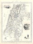 "Modern Palestine" drawn and engraved by J.Rapkin, published by The London Printing and Publishing Company, about 1853. The original is a decorative steel engraved map with original
hand colouring. Click
here for detail showing part
of the map at full resolution (400 dpi). Click the small image to the left for a larger low resolution version. (Ref sm0201). Digital image
18.6mb at 400dpi. "Modern Palestine" drawn and engraved by J.Rapkin, published by The London Printing and Publishing Company, about 1853. The original is a decorative steel engraved map with original
hand colouring. Click
here for detail showing part
of the map at full resolution (400 dpi). Click the small image to the left for a larger low resolution version. (Ref sm0201). Digital image
18.6mb at 400dpi.
Price 5 USD, Click here to buy
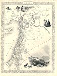 "Syria" drawn and engraved by J.Rapkin, published by The London Printing and Publishing Company, about 1853. The original is a decorative steel engraved map with original
hand colouring. The decorative vignettes include Jerusalem view, Arabs and Baggage Camels. Click
here for detail showing part
of the map at full resolution (400 dpi). Click the small image to the left for a larger low resolution version. (Ref sm0254). Digital image
18.9mb at 400dpi. "Syria" drawn and engraved by J.Rapkin, published by The London Printing and Publishing Company, about 1853. The original is a decorative steel engraved map with original
hand colouring. The decorative vignettes include Jerusalem view, Arabs and Baggage Camels. Click
here for detail showing part
of the map at full resolution (400 dpi). Click the small image to the left for a larger low resolution version. (Ref sm0254). Digital image
18.9mb at 400dpi.
Price 5 USD, Click here to buy
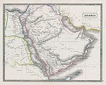 "Arabia" published in the New Edinburgh General Atlas, 1844. The original is a lithographic map with original
hand colouring. Size of the original 33 x 26 cms plus margins. Click
here for detail showing part
of the map at full resolution (400 dpi). Click the small image to the left for a larger low resolution version. (Ref sm0259). Digital image
19mb at 400dpi. "Arabia" published in the New Edinburgh General Atlas, 1844. The original is a lithographic map with original
hand colouring. Size of the original 33 x 26 cms plus margins. Click
here for detail showing part
of the map at full resolution (400 dpi). Click the small image to the left for a larger low resolution version. (Ref sm0259). Digital image
19mb at 400dpi.
Price 5 USD, Click here to buy
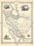 "Persia" (Iran) drawn and engraved by J.Rapkin, published by The London Printing and Publishing Company, about 1853. The original is a decorative steel engraved map with original
hand colouring. Click
here for detail showing part
of the map at full resolution (500 dpi). Click the small image to the left for a larger low resolution version. (Ref sm0187). Digital image
20.1mb at 400dpi. "Persia" (Iran) drawn and engraved by J.Rapkin, published by The London Printing and Publishing Company, about 1853. The original is a decorative steel engraved map with original
hand colouring. Click
here for detail showing part
of the map at full resolution (500 dpi). Click the small image to the left for a larger low resolution version. (Ref sm0187). Digital image
20.1mb at 400dpi.
Price 5 USD, Click here to buy
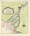 "Carte Des Embouchures de l'Euphrate" (Iraq) by Nicholas Bellin, published in Prevost's Histoire des Voyages, about 1757. The original is a copper engraved antiquemap with later
hand colouring. Click
here for detail showing part
of the map at full resolution (400 dpi). Click the small image to the left for a larger low resolution version. (Ref sm0268). Digital image
8.7mb at 400dpi. "Carte Des Embouchures de l'Euphrate" (Iraq) by Nicholas Bellin, published in Prevost's Histoire des Voyages, about 1757. The original is a copper engraved antiquemap with later
hand colouring. Click
here for detail showing part
of the map at full resolution (400 dpi). Click the small image to the left for a larger low resolution version. (Ref sm0268). Digital image
8.7mb at 400dpi.
Price 5 USD, Click here to buy
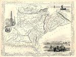 "Cabool, The Punjab and Beloochistan" (Afghanistan & Pakistan) drawn and engraved by J.Rapkin, published by The London Printing and Publishing Company, about 1853. The original is a decorative steel engraved map with original
hand colouring. Click
here for detail showing part
of the map at full resolution (500 dpi). Click the small image to the left for a larger low resolution version. (Ref sm0174). Digital image
27.3mb at 500dpi. "Cabool, The Punjab and Beloochistan" (Afghanistan & Pakistan) drawn and engraved by J.Rapkin, published by The London Printing and Publishing Company, about 1853. The original is a decorative steel engraved map with original
hand colouring. Click
here for detail showing part
of the map at full resolution (500 dpi). Click the small image to the left for a larger low resolution version. (Ref sm0174). Digital image
27.3mb at 500dpi.
Price 5 USD, Click here to buy
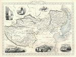 "Thibet, Mongolia and Mandchouria" (Tibet, Mongolia & Manchuria) drawn and engraved by J.Rapkin, published in Tallis's The Illustrated Atlas ..., about 1853. The original is a decorative steel engraved map with original outline
hand colouring, measuring 32.5 x 25 cms including decorative border, plus margins. The decorative vignettes include Palace of the Dalai Lama in Lhasa, Mausoleum at Teshoo Loomboo, Leh Little in Tibet, Great Wall of China and a Mongol Noble. Click
here for detail showing part
of the map at full resolution (400 dpi). Click the small image to the left for a larger low resolution version. (Ref sm0253). Digital image
19.6mb at 400dpi. "Thibet, Mongolia and Mandchouria" (Tibet, Mongolia & Manchuria) drawn and engraved by J.Rapkin, published in Tallis's The Illustrated Atlas ..., about 1853. The original is a decorative steel engraved map with original outline
hand colouring, measuring 32.5 x 25 cms including decorative border, plus margins. The decorative vignettes include Palace of the Dalai Lama in Lhasa, Mausoleum at Teshoo Loomboo, Leh Little in Tibet, Great Wall of China and a Mongol Noble. Click
here for detail showing part
of the map at full resolution (400 dpi). Click the small image to the left for a larger low resolution version. (Ref sm0253). Digital image
19.6mb at 400dpi.
Price 5 USD, Click here to buy
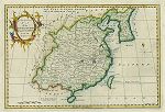 "A New & Accurate Map of the Empire of China, from the Sieur Robert's Atlas, with Improvements" by J.Gibson, published in Fenning's A New System of Geography ..., 1773. The original is a copper engraved map with recent
hand colouring. Click
here for detail showing part
of the map at full resolution (400 dpi). Click the small image to the left for a larger low resolution version. (Ref sm0263). Digital image
15mb at 400dpi. "A New & Accurate Map of the Empire of China, from the Sieur Robert's Atlas, with Improvements" by J.Gibson, published in Fenning's A New System of Geography ..., 1773. The original is a copper engraved map with recent
hand colouring. Click
here for detail showing part
of the map at full resolution (400 dpi). Click the small image to the left for a larger low resolution version. (Ref sm0263). Digital image
15mb at 400dpi.
Price 5 USD, Click here to buy
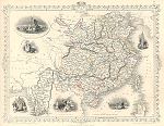 "China and Burmah" (Burma, Tallis map) drawn and engraved by J.Rapkin, published by The London Printing and Publishing Company, about 1853. The original is a steel engraved map with original
hand colouring. Click
here for detail showing part
of the map at full resolution (400 dpi). Click the small image to the left for a larger low resolution version. (Ref sm0159). Digital image
18.7mb at 400dpi. "China and Burmah" (Burma, Tallis map) drawn and engraved by J.Rapkin, published by The London Printing and Publishing Company, about 1853. The original is a steel engraved map with original
hand colouring. Click
here for detail showing part
of the map at full resolution (400 dpi). Click the small image to the left for a larger low resolution version. (Ref sm0159). Digital image
18.7mb at 400dpi.
Price 5 USD, Click here to buy
_tn.jpg) "Chinese Empire and Japan" by J. Bartholomew, published in The Popular Atlas of the World, 1885. The original is a colour lithographic map, indicating the various Chinese provinces in mid-Victorian times. Click
here for detail showing part
of the map at full resolution (400 dpi). Click the small image
to the left for a larger low resolution version. (Ref sm0075). Digital
image size 25.5 mb at 400 dpi. "Chinese Empire and Japan" by J. Bartholomew, published in The Popular Atlas of the World, 1885. The original is a colour lithographic map, indicating the various Chinese provinces in mid-Victorian times. Click
here for detail showing part
of the map at full resolution (400 dpi). Click the small image
to the left for a larger low resolution version. (Ref sm0075). Digital
image size 25.5 mb at 400 dpi.
Price 5
USD, Click here to buy
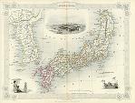 "Japan & Corea" (Korea) drawn and engraved by John Rapkin, published by
J & F Tallis, about 1851. The original is a steel engraved map with
original outline hand colouring. Click
here for detail showing part
of the map at full resolution (Tokyo area) (600 dpi). Click the small image
to the left for a larger low resolution version. NOTE - The original has a centre-fold
with slight discolouration which is visible in the digital version. (Ref sm0062). Digital
image size 30.5 mb at 600 dpi. "Japan & Corea" (Korea) drawn and engraved by John Rapkin, published by
J & F Tallis, about 1851. The original is a steel engraved map with
original outline hand colouring. Click
here for detail showing part
of the map at full resolution (Tokyo area) (600 dpi). Click the small image
to the left for a larger low resolution version. NOTE - The original has a centre-fold
with slight discolouration which is visible in the digital version. (Ref sm0062). Digital
image size 30.5 mb at 600 dpi.
Price 5
USD, Click here to buy
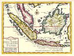 East Indies "Nuova Carta delle Isole di Sunda come Borneo Sumatra e Iava Grande ..." by Isaak Tirion, published by Albrizzi in Venice about 1740. The original is a copper engraved antique map with
recent hand colouring, measuring 38 x 28 cms plus margins. Click
here for detail showing part
of the map at full resolution (300 dpi). Click the small image
to the left for a larger low resolution version. (Ref sm0262). Digital
image size 14.3 mb at 300 dpi. East Indies "Nuova Carta delle Isole di Sunda come Borneo Sumatra e Iava Grande ..." by Isaak Tirion, published by Albrizzi in Venice about 1740. The original is a copper engraved antique map with
recent hand colouring, measuring 38 x 28 cms plus margins. Click
here for detail showing part
of the map at full resolution (300 dpi). Click the small image
to the left for a larger low resolution version. (Ref sm0262). Digital
image size 14.3 mb at 300 dpi.
Price 5
USD, Click here to buy
_tn.jpg) "East Indies " by Thomas Jefferys, published in A New Geographical and Historical Grammar ..., 1772. Includes India, and all south east Asia including the East India Islands. The original is a copper engraved antique map with
recent hand colouring, measuring 29.5 x 18.5 cms plus margins. Click
here for detail showing part
of the map at full resolution (400 dpi). Click the small image
to the left for a larger low resolution version. (Ref sm0113). Digital
image size 12.5 mb at 400 dpi. "East Indies " by Thomas Jefferys, published in A New Geographical and Historical Grammar ..., 1772. Includes India, and all south east Asia including the East India Islands. The original is a copper engraved antique map with
recent hand colouring, measuring 29.5 x 18.5 cms plus margins. Click
here for detail showing part
of the map at full resolution (400 dpi). Click the small image
to the left for a larger low resolution version. (Ref sm0113). Digital
image size 12.5 mb at 400 dpi.
Price 5
USD, Click here to buy
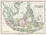 "East India Islands " (East Indies) engraved by E.Jones and published by
C.Smith in 1820. The original is a copper engraved antique map with
full original hand colouring. Click
here for detail showing part
of the map at full resolution (Singapore area) (600 dpi). Click the small image
to the left for a larger low resolution version. (Ref sm0042). Digital
image size 38 mb at 600 dpi. "East India Islands " (East Indies) engraved by E.Jones and published by
C.Smith in 1820. The original is a copper engraved antique map with
full original hand colouring. Click
here for detail showing part
of the map at full resolution (Singapore area) (600 dpi). Click the small image
to the left for a larger low resolution version. (Ref sm0042). Digital
image size 38 mb at 600 dpi.
Price 5
USD, Click here to buy
_tn.jpg) "Malay Archipelago" (East Indies) drawn and engraved by John Rapkin, published by
The London Printing & Publishing Company, about 1856. The original is a steel engraved map with
original outline hand colouring. Click
here for detail showing part
of the map at full resolution (Singapore area) (600 dpi). Click the small image
to the left for a larger low resolution version. NOTE - The original has a centre-fold
which is visible in the digital version. (Ref sm0053). Digital
image size 35 mb at 600 dpi. "Malay Archipelago" (East Indies) drawn and engraved by John Rapkin, published by
The London Printing & Publishing Company, about 1856. The original is a steel engraved map with
original outline hand colouring. Click
here for detail showing part
of the map at full resolution (Singapore area) (600 dpi). Click the small image
to the left for a larger low resolution version. NOTE - The original has a centre-fold
which is visible in the digital version. (Ref sm0053). Digital
image size 35 mb at 600 dpi.
Price 5
USD, Click here to buy
|
|

